 ultimate-guide
Aerial Inspections for Construction Management: 2026 Guide
Table of Contents
- Why Aerial Inspections Are Reshaping Construction Management
- Drone Photogrammetry for Construction: From Orthomosaic Maps to Digital Twins
- FAA Part 107 Drone Requirements Every Construction Team Should Know
- Construction Site Progress Documentation That Actually Tracks the Schedule
- Safety, Risk Mitigation, and Hazardous Area Inspection
- BIM Integration and Data Workflows for Aerial Inspections
- Liability, Insurance, and Data Security for Aerial Inspections
- Conclusion
- Frequently Asked Questions
Last Updated: October 1, 2026
Why Aerial Inspections Are Reshaping Construction Management
The biggest shift in construction management isn't a new material or a faster crane. It's the view from above. Aerial inspections, the practice of using unmanned aerial vehicles to capture site data, have moved from novelty to necessity on projects of every size. At Phoenix Drone Pros, we've watched this change firsthand over more than a decade of commercial flight work.
Drone Photogrammetry for Construction: From Orthomosaic Maps to Digital Twins
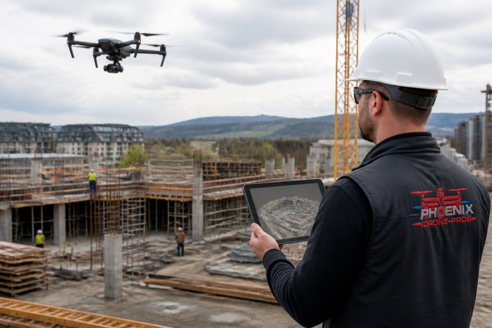
Drone photogrammetry for construction stitches hundreds of overlapping aerial photos into measurable 2D and 3D site models. The output starts as an orthomosaic map, a geometrically corrected image where every pixel maps to a real-world coordinate, and ends as a point cloud or digital twin you can measure against the design.
LiDAR, Thermal Imaging, and Sensor Selection
Sensor choice drives everything downstream. RGB cameras handle visual progress documentation and photogrammetry. LiDAR cuts through vegetation and low light to produce dense point clouds. Thermal imaging surfaces moisture intrusion, insulation gaps, and electrical hot spots a standard camera cannot see.
FAA Part 107 Drone Requirements Every Construction Team Should Know
FAA Part 107 is the rule set governing commercial drone operations, and it applies to every flight a construction firm conducts or contracts. The FAA's official Part 107 overview covers the core requirements: a Remote Pilot Certificate, registration for aircraft over 0.55 pounds, and operations within visual line of sight unless a waiver is granted.
Construction Site Progress Documentation That Actually Tracks the Schedule
Aerial progress documentation only earns its keep when it maps to the schedule. The useful approach is a fixed flight path repeated on a set cadence, so each capture lines up with the last and change becomes visible.
A practical workflow:
- Define automated flight paths over the site perimeter and key structures
- Fly the same path weekly or biweekly
- Process images into an orthomosaic and compare against the prior capture
- Overlay the current model on the design to flag deviations
- Share annotated captures with owners and lenders
Safety, Risk Mitigation, and Hazardous Area Inspection
The strongest case for aerial inspections is that they remove people from danger. Roof edge surveys, high-steel progress checks, and hazardous area inspection all happen today with a person on a ladder, a swing stage, or an articulating boom lift. A drone does the same work without putting a body at height.
What Aerial Inspection Actually Replaces
To scope a drone program, list the tasks on your site that currently require someone at height or in a confined space, then ask which produce a visual or thermal deliverable. Common candidates:
- Roof edge and parapet surveys, membrane seams, flashing failures, ponding, and hail or wind damage, captured without a crew on the roof.
- High-steel and structural steel progress checks, bolt-up verification, connection inspection, and coating condition on members that would otherwise require climbing.
- Facade and curtain wall inspection, sealant joints, spandrel panel damage, and water intrusion paths on mid- and high-rise exteriors.
- Confined space and tank interiors, where a drone with a cage and lighting can document condition before anyone enters, reducing the number of permit-required confined space entries.
- Hazardous area inspection, areas with unstable ground, active demolition, or chemical exposure where sending a person in is the last resort.
Sensor Choice Changes What You Can See
The sensor, not the airframe, determines what a hazardous-area flight can deliver. A standard RGB camera documents visible condition. A thermal (infrared) payload surfaces moisture intrusion, insulation gaps, delamination, and electrical hot spots a visual walkthrough will miss entirely, a wet roof membrane reads as a cool patch in the thermal image long before it shows as a stain on the ceiling below.
Risk Mitigation Beyond the Flight
The risk reduction is not only about the person who would have climbed. Aerial inspection also reduces how often you mobilize a lift, scaffold, or crane for a look-and-see task, removing the struck-by, tip-over, and fall-from-elevation exposures that equipment brings to an active site. For occupied buildings, it means inspections with no tenant disruption and no scaffolding cost.
Where Aerial Inspection Does Not Replace a Person
A drone is not a substitute for a hands-on inspection where the standard requires physical contact or a qualified person's judgment. Structural welds requiring visual inspection per AWS D1.1, electrical terminations needing torque verification, and any condition a code or specification says must be physically examined still require a person. Aerial inspection reduces how often a person is exposed, not the need for one.
BIM Integration and Data Workflows for Aerial Inspections
BIM integration is where most construction teams leave value on the table. A drone flight produces geospatial data, but that data is only as useful as its path into the model. The workflow runs: capture, process into a point cloud or orthomosaic, register to site coordinates, then import into the BIM environment for comparison.
The Coordinate Problem Nobody Warns You About
The technical requirement that decides whether BIM integration works is coordinate alignment. If drone data is not georeferenced to the same system as the design model, the overlay is meaningless, a pretty picture that looks aligned on screen but is off by feet in the field. Three coordinate systems are in play on most projects, and they must be reconciled:
- The design model's coordinate system, often a project-specific origin set by the architect or civil engineer, sometimes tied to a state plane or a local grid.
- The drone's GNSS output, typically WGS84 latitude, longitude, and ellipsoid height, which is a global system, not a project system.
- The site's control network, the physical monuments and benchmarks the surveyor set, which define the project's real-world position.
File Formats and the Import Path
Once processed, the deliverable format determines how the data enters the BIM environment. Common outputs and their destinations:
- Orthomosaic (GeoTIFF), a georeferenced 2D image, useful as an underlay in site plans and for progress comparison against the previous capture.
- Point cloud (LAS or LAZ), the dense 3D dataset, imported into tools like Autodesk ReCap or directly into Revit or Navisworks for clash and deviation review.
- Mesh (OBJ or FBX), a textured surface model, useful for visualization and for comparing as-built surface against design surface.
- Digital twin / reality mesh, a navigable 3D representation that can be published to a common data environment for stakeholders who do not have BIM authoring software.
NIBS guidance on building information modeling
What You Actually Do With the Overlay
Importing the data is not the point, the comparison is. Once the point cloud is registered to the design model, three workflows become possible:
- Deviation analysis, measure the as-built surface against the design surface to flag where the work is out of tolerance, before the next trade covers it up.
- Progress verification, quantify installed quantities (linear feet of pipe, square feet of deck, cubic yards of stockpile) from the model rather than from a walkthrough estimate.
- Clash and coordination review, overlay the as-built point cloud on the coordinated model to catch field conflicts that the model did not predict.
A Practical Cadence
A workable pattern is to fly the same automated flight path on a set cadence, weekly, biweekly, or tied to a milestone, and process each capture to the same coordinate system. Each new point cloud is compared against the prior one for change detection and against the design model for deviation. Over the project's life, that produces a dated, georeferenced record of what was built and when, exactly the evidence that settles schedule and payment disputes.
Liability, Insurance, and Data Security for Aerial Inspections
Liability and insurance questions decide more drone programs than hardware ever does. The operator carries aviation liability, but the site owner and general contractor can still face exposure if a flight goes wrong. The fix is contractual: require the operator to name the project as an additional insured and hold a current Part 107 certificate.
| Risk Area | What to Verify | Who Owns It |
|---|---|---|
| Aviation liability | Certificate of insurance, additional insured | Drone operator |
| Regulatory compliance | Part 107 certificate, airspace authorization | Drone operator |
| Data privacy | Storage, access controls, retention policy | Site owner and operator |
| Site security | Footage handling and distribution rules | Project manager |
Conclusion
Running a drone program in-house means certificates, waivers, sensor decisions, and processing pipelines most construction teams don't have the bandwidth to maintain. Phoenix Drone Pros handles that layer for you, with FAA-certified, fully insured pilots and more than a decade of commercial experience. From reliable construction progress documentation to thermal roof inspections and 3D mapping, we deliver the aerial data that keeps your project on schedule.
Frequently Asked Questions
Do I need a license to fly a drone for roof inspections or construction site monitoring?
Yes. Commercial drone work falls under FAA Part 107, which requires a Remote Pilot Certificate. You must pass the aeronautical knowledge test, register the aircraft, and follow operating rules like staying under 400 feet and within visual line of sight. For construction sites near airports, you may also need airspace authorization through LAANC. Hiring an FAA-certified team means the pilot, insurance, and airspace approvals are already handled, so your project stays compliant without added paperwork.
What is the difference between aerial photography and drone photogrammetry for construction?
Aerial photography captures still images or video for visual documentation, marketing, and quick progress checks. Drone photogrammetry goes further: it stitches hundreds of overlapping photos into orthomosaic maps, point clouds, and 3D models you can measure. That means accurate volumes, distances, and elevation data you can compare week to week. For construction management, photogrammetry supports quantity takeoffs, cut-and-fill calculations, and BIM coordination, while photography handles the visual record and stakeholder updates.
How often should aerial inspections be conducted during a construction project?
Frequency depends on project phase and schedule risk. Many teams fly weekly during active construction, then daily during critical milestones like steel erection or concrete pours. Slow periods may only need monthly flights. The key is consistency: flying from the same automated flight paths each time produces comparable orthomosaic maps and point clouds, so you can spot deviations early. Aligning flight dates with pay applications or owner meetings also makes progress documentation more useful for billing and dispute resolution.
What certifications and insurance should a professional aerial inspection team hold?
Look for an FAA Part 107 Remote Pilot Certificate for every pilot, active liability insurance that covers commercial drone operations, and a certificate of insurance you can request before work begins. Teams with experience in construction documentation often carry additional coverage for data deliverables and can provide references from general contractors. Confirm they handle airspace authorizations and have a written safety plan. Certifications plus a track record on similar sites matter more than equipment specs alone.