 ultimate-guide
Aerial Construction Monitoring: Benefits & Best Practices
Table of Contents
- Why Aerial Construction Monitoring Matters
- Real-Time Site Progress Tracking and Data Collection
- Safety Improvements and Hazard Detection
- Cost Reduction and Jobsite Efficiency Gains
- Reliable Construction Progress Documentation for Property Management
- FAA Part 107 Construction Drone Requirements and Compliance
- Understanding the Cost of Aerial Construction Monitoring Services
- Conclusion
Last Updated: August 25, 2026
Why Aerial Construction Monitoring Matters
Construction projects live or die on visibility. Project managers need to know what's happening on site in real time, not days later when a report lands on their desk. Aerial construction monitoring solves this fundamental problem by giving stakeholders an accurate, current view of jobsite conditions, progress, and potential issues.
The shift from ground-level inspections to aerial monitoring represents more than a technology upgrade. It's a fundamental change in how teams track construction workflow, identify safety hazards, and make data-driven decisions. When you can see the entire project from above, you catch problems early, prevent costly delays, and keep everyone aligned on what's actually happening versus what the schedule says should be happening.
This matters because construction projects are expensive, time-sensitive, and complex. A single week of delay on a multi-million-dollar project costs real money. A missed safety incident costs lives. Inaccurate progress documentation creates disputes between contractors, owners, and lenders. Aerial construction monitoring addresses all three problems at once by delivering reliable, timestamped visual evidence of project conditions.
At Phoenix Drone Pros, we've worked with developers, general contractors, and property managers who've shifted to aerial monitoring.
Real-Time Site Progress Tracking and Data Collection
Real-time site progress tracking means you have current visual data of your jobsite whenever you need it, not waiting for a scheduled site visit or relying on verbal updates from field staff. Aerial imagery captures the actual state of construction at a specific moment, creating an objective record that everyone can reference.
This approach works because unmanned aerial vehicles can access vantage points that ground-level photography cannot. A drone can capture orthomosaic maps, stitched, georeferenced images that show the entire site from above, in minutes. These images become the foundation for accurate progress documentation, allowing project managers to compare week-to-week changes, verify that work is proceeding according to schedule, and identify bottlenecks or deviations before they cascade into larger problems.
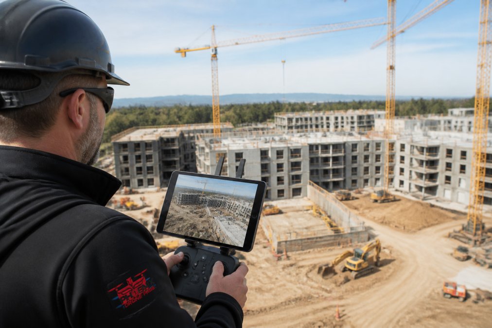
The data collected through aerial construction monitoring feeds directly into project management workflows. Instead of relying on manual site reports or subjective assessments, teams work from timestamped visual evidence. This eliminates ambiguity about what work has been completed, what remains, and whether the project is tracking to schedule. When disputes arise about progress or completion, the aerial imagery provides the definitive record.
Real-time reporting also improves stakeholder communication. Lenders, investors, and owners want visibility into their projects. Aerial construction monitoring delivers that visibility in a format that's immediately understandable, clear overhead views that show exactly what's been built, what's in progress, and what hasn't started yet. This transparency builds confidence and reduces the friction that often develops when stakeholders feel uninformed about project status. For commercial real estate transactions, this documentation is particularly valuable, a Video Offering Memorandum enhanced with current aerial imagery provides potential buyers or lenders with compelling, up-to-date visual evidence of property conditions and construction progress.
Safety Improvements and Hazard Detection
Construction sites present constant hazards. Falls, struck-by incidents, equipment failures, and unsafe working conditions cause injuries and fatalities every year (the CDC). Aerial construction monitoring creates a new layer of safety oversight by enabling remote hazard detection and site inspection without putting additional personnel in dangerous positions.
A drone can identify safety incidents and hazard conditions from above, workers without proper fall protection, unsecured materials, equipment operating in proximity to personnel, or environmental hazards like unstable excavations. This remote monitoring capability means safety managers can review site conditions continuously rather than relying on periodic walk-throughs. The aerial perspective also reveals site logistics issues that create safety risks: congestion in material staging areas, blocked emergency routes, or inadequate spacing between equipment and work zones.
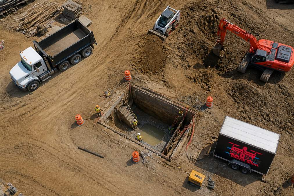
Beyond identifying existing hazards, aerial construction monitoring supports proactive safety planning. By reviewing aerial imagery before work begins, safety teams can identify potential risks in site layout, plan safer equipment positioning, and establish work zones that minimize exposure. This shifts safety from reactive (responding to incidents) to predictive (preventing them before they occur).
Documentation is equally critical. When a safety incident does occur, having timestamped aerial footage of the site conditions before, during, and after the incident provides objective evidence for investigation, insurance claims, and regulatory compliance. This documentation protects both workers and the organization by creating an accurate record of what actually happened.
Cost Reduction and Jobsite Efficiency Gains
Construction projects consume resources constantly, labor, equipment, materials, and time. Inefficiency in any of these areas directly impacts the bottom line. Aerial construction monitoring identifies inefficiencies that ground-level management often misses, creating opportunities for cost reduction across multiple areas.
One major efficiency gain comes from reduced site survey time. Traditional surveying and site inspections require personnel to physically walk the jobsite, locate specific features, measure distances, and document conditions. This process is slow and labor-intensive. Aerial imagery and photogrammetry, the process of creating accurate measurements from photographs, accomplish the same work faster and more accurately. A drone can capture data for topographic surveys and as-built verification in a fraction of the time required for traditional methods.
Equipment use improves when managers have accurate visibility into site conditions. Cranes, excavators, and other expensive equipment sitting idle represents wasted cost. Aerial monitoring reveals congestion, material staging inefficiencies, and workflow bottlenecks that prevent equipment from being used productively. When these issues are identified quickly, crews can adjust workflow to keep equipment moving and productive.
Material management also benefits from aerial oversight. Drone imagery reveals material stockpile locations, identifies where materials are being stored inefficiently, and shows when materials have been delivered but not yet moved to where they're needed. This visibility helps prevent duplicate orders, reduces waste, and improves the efficiency of material handling crews. drone footage benefits.
Labor productivity increases when crews have clear, current information about what work needs to be done and in what sequence. Aerial construction monitoring provides this information automatically. Instead of waiting for a supervisor's verbal briefing or relying on potentially outdated plans, crews can see the actual site conditions and understand what work is ready to proceed versus what's blocked by incomplete prior work.
Reliable Construction Progress Documentation for Property Management
Property managers and facility teams need to understand what's been completed, what's in progress, and what remains on their projects. Reliable construction progress documentation, the detailed, timestamped record of work completed at specific points in time, is essential for managing budgets, timelines, lenders, and stakeholder expectations.
Aerial construction monitoring creates this documentation automatically. Each aerial survey produces a timestamped visual record of site conditions at that specific moment. When you conduct surveys at regular intervals, weekly, bi-weekly, or monthly, you build a complete visual history of the project from start to finish. This history becomes the foundation for accurate progress claims, payment applications, and project close-out documentation.
The documentation also supports as-built verification. As work is completed, aerial imagery confirms that what was built matches what was designed. This verification is critical for quality assurance and for creating accurate as-built records that will be needed for maintenance, future renovations, and regulatory compliance. Digital twin technology, creating a 3D digital model of the completed construction, increasingly relies on aerial imagery and photogrammetry data as its source.
For property management specifically, this documentation creates a permanent visual record of how the property evolved. This record is valuable for understanding existing conditions, planning future renovations or expansions, and defending against claims about construction quality or completion. When disputes arise about whether specific work was completed or completed correctly, the aerial imagery provides objective evidence.
FAA Part 107 Construction Drone Requirements and Compliance
Operating a drone for commercial purposes, including construction site monitoring, requires compliance with Federal Aviation Administration regulations. Understanding these requirements is essential before implementing an aerial construction monitoring program.
The FAA Part 107 rule governs commercial drone operations (faa.gov). This regulation requires that anyone operating a drone for compensation must hold a Remote Pilot Certificate, commonly called a Part 107 license. This certification requires passing a knowledge test that covers airspace regulations, safety procedures, weather considerations, and emergency protocols (faa.gov). The pilot must also maintain currency through regular operations and recurrent training. Professional operators often pursue drone flight training to deepen their expertise and stay current with evolving regulations and best practices.
Beyond pilot certification, Part 107 establishes operational rules that apply to all commercial drone flights. These include requirements that the drone remain within visual line of sight of the operator, that flights occur during daylight hours, that the drone stay below 400 feet altitude, and that operations occur in airspace that hasn't been restricted or prohibited by the FAA. Construction sites often require coordination with local air traffic control facilities or obtaining special authorizations if the site is near an airport or in controlled airspace.
Insurance requirements also apply to commercial drone operations. Liability coverage protects against claims if the drone causes property damage or injury. Most commercial drone operators carry insurance policies specifically designed for this purpose, typically covering both hull damage (damage to the drone itself) and liability (damage caused by the drone to other property or people).
Compliance with these requirements isn't optional, it's fundamental to operating safely and legally. Operators who ignore Part 107 requirements face substantial fines and potential criminal penalties. More importantly, non-compliant operations create genuine safety risks. The regulations exist because uncontrolled drone flights have caused near-miss incidents with manned aircraft and have posed risks to people and property on the ground.
When selecting a drone service provider for construction site monitoring, verification of Part 107 certification and insurance should be non-negotiable. Phoenix Drone Pros maintains FAA Part 107 certification for all pilots and carries full liability insurance, ensuring that construction site monitoring is conducted safely and in compliance with all applicable regulations.
Understanding the Cost of Aerial Construction Monitoring Services
Pricing for aerial construction monitoring services varies based on several factors, and understanding these variables helps you evaluate whether the investment makes sense for your project.
Service costs depend primarily on the scope of work, frequency of monitoring, and complexity of the site. A small residential project requiring monthly progress documentation costs significantly less than a large commercial development that needs weekly monitoring and detailed 3D mapping. The type of deliverables also affects pricing, basic aerial photography costs less than orthomosaic maps or full photogrammetry analysis that produces measurement-grade data.
Frequency matters substantially. A single aerial survey costs less than a regular monitoring program, but ongoing monitoring, weekly or bi-weekly, spreads costs across multiple flights and often benefits from volume discounts. Many operators offer monthly or quarterly monitoring packages that are more cost-effective than booking individual flights.
Site accessibility and complexity also influence cost. A straightforward rectangular site with clear boundaries costs less to monitor than a complex site with multiple buildings, significant elevation changes, or obstacles that require careful flight planning. Sites near airports or in restricted airspace may require additional coordination and special authorizations that add to the cost.
The best approach to understanding pricing is to contact a qualified provider and discuss your specific project requirements. Phoenix Drone Pros offers custom quotes based on your site's characteristics, monitoring frequency, and deliverable requirements. Rather than guessing at costs, getting a detailed quote allows you to understand exactly what you're investing in and what return you can expect from improved progress tracking, safety oversight, and documentation.
Consider the cost against the value delivered. A single week of project delay on a multi-million-dollar construction project costs far more than weekly aerial monitoring. Preventing safety incidents, reducing equipment downtime, and improving stakeholder communication create measurable returns that typically exceed the cost of the monitoring service itself.
Aerial construction monitoring has become essential infrastructure for professional construction management. The combination of real-time progress tracking, safety oversight, accurate documentation, and stakeholder communication creates value that extends far beyond the cost of the service. When you're managing construction projects where accuracy, safety, and timeline control matter, aerial monitoring isn't a luxury, it's a practical necessity.
At Phoenix Drone Pros, our FAA-certified team brings over a decade of commercial drone experience to construction site monitoring. We understand the specific documentation, safety, and communication challenges that construction teams face, and we've built our services around delivering the data and imagery that actually drive better project outcomes. Whether you need weekly progress monitoring, safety documentation, or detailed 3D mapping, we provide reliable, professional-quality aerial construction monitoring tailored to your project's specific requirements.
Ready to improve your construction project visibility and control? Contact Phoenix Drone Pros to discuss your project and get a custom quote for aerial construction monitoring services.
Frequently Asked Questions
What are the main benefits of using aerial construction monitoring on a project?
Aerial construction monitoring delivers actionable insights that improve decision-making throughout the project lifecycle. Key benefits include real-time site progress tracking, enhanced hazard detection for safety incidents, automated reporting that reduces manual documentation time, and data-driven visibility into jobsite efficiency. Stakeholders gain transparency through remote monitoring capabilities, enabling faster approvals and reduced project delays. For construction workflows involving multiple buildings or complex layouts, aerial imagery provides the spatial resolution needed for accurate as-built verification and quality control.
How does aerial monitoring compare to traditional ground-based site inspections?
Aerial monitoring captures comprehensive site views that ground-based methods cannot achieve, especially for large projects or properties with difficult-to-access areas. Unmanned aerial vehicles can document site conditions in minutes rather than hours, reducing site survey time significantly. Aerial imagery enables photogrammetry and orthomosaic map creation, providing elevation data and topographic surveys that traditional inspections miss. While both methods have value, aerial monitoring excels at detecting safety hazards, tracking progress across the entire jobsite, and creating digital records for stakeholder communication and compliance tracking.
What FAA Part 107 construction drone requirements must I know about?
FAA Part 107 regulations govern commercial drone operations, including construction site monitoring. Key requirements include pilot certification (Part 107 license), maintaining visual line of sight, operating during daylight hours, staying below 400 feet altitude, and following local airspace rules. Construction sites near airports or restricted airspace may need additional waivers. Professional operators like Phoenix Drone Pros maintain FAA certification and insurance, ensuring compliance and protecting your project from liability. Always verify that your aerial monitoring provider holds current Part 107 certification before engagement.
How is pricing structured for aerial construction monitoring services?
The cost of aerial construction monitoring services depends on project scope, site size, frequency of monitoring (weekly, bi-weekly, monthly), deliverable type (photos, video, 3D mapping), and turnaround time. Larger sites requiring multiple flights or advanced orthomosaic mapping typically cost more than single-visit inspections. Most providers offer customized quotes based on your specific needs rather than fixed pricing. Contact Phoenix Drone Pros directly for current pricing and a personalized estimate tailored to your construction project requirements.
This article was written using GrandRanker