 ultimate-guide
Commercial Drone Site Mapping Benefits for Construction
Table of Contents
- What Is Drone Site Mapping and Why Does It Matter?
- The Key Benefits of Commercial Drone Site Mapping
- Drone Mapping vs. Traditional Surveying Methods
- Drone Construction Progress Documentation That Keeps Projects on Track
- Choosing the Right Drone Mapping Software for Construction
- FAA Part 107 Commercial Drone Requirements: What You Must Know
- Getting Started with Commercial Drone Mapping
- Conclusion
- Frequently Asked Questions
Last Updated: September 4, 2026
What Is Drone Site Mapping and Why Does It Matter?
Drone site mapping uses an unmanned aerial vehicle equipped with high-resolution cameras or LiDAR sensors to capture georeferenced aerial data over a property, processed into accurate 2D maps and 3D models. For construction professionals, this technology replaces slow, manual ground surveys with a comprehensive aerial perspective captured in a fraction of the time, delivering survey-grade data that drives decisions on earthworks, layout, and progress tracking.
At Phoenix Drone Pros, we have spent over a decade applying these methods across complex projects. The core value proposition is simple: you gain a complete, measurable picture of your site without walking every inch of it.
The Key Benefits of Commercial Drone Site Mapping
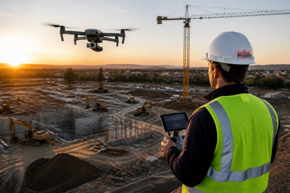
The practical advantages of commercial drone site mapping cluster around three outcomes: speed, safety, and actionable data. While traditional methods might take days to survey a parcel, a drone can capture the necessary imagery in a single flight, often under an hour, without sacrificing accuracy; modern photogrammetry software and RTK-enabled drones deliver measurements within centimeters.
Speed and Efficiency Gains
Time is the most expensive line item on any construction budget. A drone flight for data collection typically takes 20 to 40 minutes per site, compared to a full day for a two-person survey crew, allowing for more frequent data collection and a constant pulse on site conditions (ascelibrary.org).
Improved Safety on Site
Sending personnel into active excavation zones or near unstable structures carries inherent risk. Drones eliminate that exposure by keeping the operator at a safe distance, particularly for inspections of high walls, crane operations, and other hazardous areas where a physical walk-down would require extensive safety protocols.
Drone Mapping vs. Traditional Surveying Methods
The debate between drone mapping and traditional surveying is not about replacement, but about optimization. A licensed land surveyor still provides the legal boundary determination and control points that anchor a project, but for volumetric analysis, topographic mapping, and progress tracking, drone site mapping offers a distinct advantage in speed and data density.
Traditional methods rely on a total station or GPS rover to collect discrete points one at a time, while a drone collects millions of points via photogrammetry, creating a dense point cloud that represents the entire surface. This difference is critical for stockpile volume calculations, where a sparse point set can miss significant terrain variations.
| Method | Data Density | Typical Capture Time | Best Suited For |
|---|---|---|---|
| Traditional Survey | Single points | Full day | Legal boundaries, control points |
| Drone Photogrammetry | Millions of points | 20-40 minutes | Topographic maps, volumes, progress |
| Drone LiDAR | 3D point cloud | 30-60 minutes | Vegetated terrain, corridors |
Drone Construction Progress Documentation That Keeps Projects on Track
Reliable drone construction progress documentation is the bridge between the planned schedule and on-the-ground reality. Flying a site on a consistent cadence, weekly or biweekly, creates a chronological, georeferenced visual record that allows stakeholders to verify work matches the plan, settle disputes, and communicate status with lenders or investors.
The real power lies in comparing datasets over time. Overlaying a current orthomosaic with a previous one lets you calculate exact cut and fill volumes, confirm foundations are poured to spec, and track underground utility installation. The value compounds with regularity, so establish a flight schedule at project kickoff and stick to it.
Choosing the Right Drone Mapping Software for Construction
The drone is only half the equation; the drone mapping software for construction turns raw images into usable data. The market splits into cloud-based processing platforms, which offer convenience and scalability, and desktop applications, which provide more control over processing parameters and keep sensitive data on your own servers.
Cloud Processing Platforms
Cloud platforms like DroneDeploy, Propeller, and Pix4Dcloud dominate the construction sector because they are built around project collaboration and progress tracking. DroneDeploy is widely adopted for its intuitive interface and direct integrations with tools like Procore. Propeller differentiates itself with a strong focus on earthworks, offering automated GCP placement and volume reports formatted for payment applications. Pix4Dcloud provides a middle ground, allowing cloud processing while leveraging the desktop-grade accuracy of the Pix4D engine.
A key advantage of cloud platforms is their ability to host and compare multiple flights over time. Most include a 'compare' feature that overlays two surveys and calculates cut/fill volumes automatically, generating a color-coded heat map showing exactly where material has been moved, turning raw data into a stakeholder-ready report in minutes.
Desktop Processing Applications
Desktop applications, led by Pix4Dmapper and Agisoft Metashape, remain the standard for projects requiring maximum control over processing parameters or where data security mandates imagery never leaves your network. Pix4Dmapper is the industry benchmark for photogrammetry, offering granular control over keypoint extraction, mesh density, and georeferencing. Agisoft Metashape is a cost-effective alternative with comparable quality, though its interface is less polished.
The primary trade-off is computational load. Desktop processing requires a workstation with a powerful GPU and substantial RAM; a typical 500-image dataset can take several hours on a mid-range laptop. Cloud platforms offload this burden but charge per processing credit. For one flight per week, cloud processing might cost $500-$1,000 per month, whereas a desktop license is a one-time purchase of $3,000-$5,000, plus the cost of a capable workstation.
Output Format and Interoperability
Before committing to any platform, verify that its export options align with your engineering and design tools. The most common outputs are orthomosaics (GeoTIFF), point clouds (LAS/LAZ), and digital elevation models (GeoTIFF), which your civil engineers will likely need in Autodesk Civil 3D or Bentley MicroStation formats. Most platforms export directly to these formats, but some require a conversion step that can degrade accuracy.
A Practical Selection Framework
Start with a pilot project on a single site. Upload a dataset of 200-300 images to two or three candidate platforms and compare the resulting orthomosaics against a known control point. Measure the root mean square error (RMSE) in the processing report; a reliable platform should achieve an RMSE under 2 centimeters when using GCPs. Assess the time from upload to finished output, and test the collaboration features, can you share a link with a project owner who does not have a license? The ability to distribute interactive maps to stakeholders without requiring them to purchase software is often the deciding factor.
FAA Part 107 Commercial Drone Requirements: What You Must Know
Operating a drone for any commercial purpose, including construction site mapping, requires compliance with FAA regulations. The foundation of this compliance is the FAA Part 107 certification, which mandates that remote pilots hold a Remote Pilot Certificate. This involves passing a knowledge test covering airspace classification, weather, and operating rules, and the certificate must be renewed every two years.
Beyond the pilot certificate, the aircraft must be registered and marked, and operations must adhere to rules regarding visual line of sight, altitude limits, and airspace authorization. Flying near airports or in controlled airspace requires an LAANC authorization, often obtainable in real time through an app. For construction sites, verify that the flight area is clear of people not involved in the operation, unless the aircraft has a remote ID and is operated under the appropriate waiver. Navigating these rules is a core reason why many developers choose a fully insured and certified service provider like Phoenix Drone Pros rather than building an in-house operation. For teams that need to get their own pilots up to speed quickly, Done flight training provides a structured path to certification and operational proficiency.
Getting Started with Commercial Drone Mapping
Implementing commercial drone mapping begins with defining the specific questions you need the data to answer, whether tracking earthwork volumes for payment applications, documenting existing conditions for a renovation, or monitoring erosion control compliance. The use case determines your flight parameters, including altitude, overlap, and the need for GCPs or RTK correction.
The Data-to-Insight Pipeline: What Happens After the Flight
Most guides stop at data collection, but the real value emerges in the post-processing workflow. Understanding this pipeline is what separates a usable survey from a collection of pretty pictures.
Mission Planning. Flight planning software (such as DJI Pilot 2, DroneDeploy, or Pix4Dcapture) automates the capture of aerial imagery. You set the altitude, which determines ground sample distance (GSD), the physical size of each pixel. At 400 feet, a typical camera produces a GSD of approximately 1.5 centimeters (fsu.edu). You also set the image overlap, typically 75% front and 60% side for photogrammetry; this redundancy is essential, as the software needs to see the same ground feature from multiple angles to triangulate its position in 3D space.
Ground Control Points (GCPs). For survey-grade accuracy, you cannot rely solely on the drone's onboard GPS, which has an accuracy of roughly 3-5 meters. Instead, you place GCPs, high-contrast targets (often black-and-white checkerboards) on the ground at known coordinates, established by a surveyor using a GNSS rover with centimeter-level accuracy. The processing software uses these known points to georeference the final map, correcting for any drift in the drone's positioning. A typical 10-acre site requires 5-8 GCPs placed at the perimeter and center. Skipping GCPs and relying on RTK-enabled drones alone can introduce errors of 5-10 centimeters, acceptable for progress tracking but insufficient for earthwork payment calculations.
Post-Processing: From Images to Orthomosaic. After the flight, the raw images are uploaded to processing software, which performs three key steps: (1) feature matching, identifying common points across overlapping images; (2) bundle adjustment, calculating camera positions and refining 3D geometry; and (3) dense reconstruction, generating a point cloud of millions of points. From this point cloud, it creates an orthomosaic, a geometrically corrected, stitched image where every pixel is georeferenced. This orthomosaic is the deliverable you import into CAD software for volume calculations or overlay with design files for progress comparison.
The RTK vs. GCP Decision
A common question is whether RTK (Real-Time Kinematic) drones eliminate the need for GCPs. RTK drones receive real-time corrections from a base station or satellite network, improving positioning accuracy to 1-2 centimeters. In practice, most professional mappers still use GCPs for critical work, because RTK corrects the drone's position but does not account for camera lens distortion or terrain variations. The industry standard is to use RTK for efficiency and place 2-3 GCPs as a quality check; if the processed map aligns with those checkpoints within tolerance, you can trust the dataset.
Processing Time and Computational Requirements
A typical construction site survey of 20-50 acres produces 300-800 images. Processing this dataset on a desktop workstation with a modern GPU takes 2-6 hours; cloud platforms can reduce this to 30-60 minutes by distributing computation across multiple servers. However, cloud processing requires uploading large files, a 500-image dataset can be 10-20 gigabytes, which can be slow on a job-site internet connection. Many teams capture data on site, return to the office, and initiate processing overnight so results are ready by morning.
A Practical First-Flight Checklist
For teams that lack the equipment or expertise in-house, professional drone service providers offer a turnkey solution, delivering processed data ready for your CAD software without the capital investment in hardware and training. This approach lets you benefit from the technology immediately while focusing your internal resources on acting on the data.
If you are building an in-house capability, start with a single site and a clear objective. Fly the site, process the data, and compare the results against a traditional ground survey to validate accuracy. Document the workflow, including flight parameters and GCP placement, so you can replicate it consistently. The goal is not to become a surveying firm but to establish a repeatable process that delivers reliable data every time you fly.
Conclusion
Adopting drone site mapping moves you from reactive problem-solving to proactive, data-backed management. The benefits of speed, safety, and precise documentation are too significant to ignore in a competitive industry where margins are tight and schedules are non-negotiable.
The challenge lies in execution: from navigating FAA Part 107 rules to selecting the right sensors and software. A misstep in any of these areas can lead to unusable data or regulatory fines. For project managers who need reliable results without the overhead of building a flight department, partnering with an expert is the most efficient path. Phoenix Drone Pros offers FAA-certified pilots, comprehensive insurance, and over a decade of commercial experience to deliver the accurate construction progress documentation you need. Get started with Phoenix Drone Pros and put a complete, measurable aerial view of your site to work this week.
Frequently Asked Questions
How accurate is commercial drone mapping compared to traditional methods?
With the use of RTK (Real-Time Kinematic) GPS and GCPs (Ground Control Points), commercial drone mapping achieves survey-grade accuracy, often within 1-2 centimeters. This matches or exceeds the precision of traditional ground-based methods for most site applications. This level of accuracy is essential for creating reliable topographic maps, performing volumetric analysis, and ensuring construction progress documentation aligns with design plans.
What is drone mapping used for in construction?
Drone mapping is used for several critical tasks: tracking progress with orthomosaic and 3D models, performing volumetric analysis of stockpiles, creating digital twins for project lifecycle management, and conducting site monitoring. It provides project managers with an accurate, up-to-date view of the entire site, which helps in identifying issues early, verifying work against plans, and communicating progress to stakeholders.
How does drone mapping improve construction site safety?
Drone mapping improves safety by reducing the need for personnel to physically access hazardous or difficult-to-reach areas. Instead of walking through an active site to collect data, a pilot can capture everything from a safe distance. This minimizes the risk of falls, trips, and accidents involving heavy machinery, while still providing detailed data for infrastructure inspection and site monitoring.
This article was written using GrandRanker