 ultimate-guide
Drone 3D Mapping for Developers: APIs, Data, and Integration
Table of Contents
- What Is Drone 3D Mapping for Developers?
- How Photogrammetry and Point Cloud Processing Work
- Drone Photogrammetry Software for Construction: Integration and Workflow
- APIs and SDKs for 3D Mapping Integration
- Cloud vs. Desktop Processing: Choosing Your Data Pipeline
- Construction Site Progress Documentation Best Practices
- FAA Part 107 Requirements for Mapping Operations
- Open-Source vs. Proprietary Engines: Cost and Capability Trade-offs
Last Updated: August 30, 2026
What Is Drone 3D Mapping for Developers?
Drone 3D mapping for developers is the practice of using unmanned aerial vehicles to capture geospatial data and reconstruct three-dimensional environments through programmatic APIs and software development kits. Unlike end-user mapping tools that deliver finished visualizations, developer-focused solutions provide raw data pipelines, point clouds, orthomosaics, and mesh reconstructions that integrate directly into custom applications. At Phoenix Drone Pros, we've worked with construction teams and facility managers who needed to move beyond static imagery to actionable spatial intelligence through APIs and SDKs rather than pre-built software alone.
The core difference lies in the data layer. Standard drone photogrammetry software produces beautiful outputs for human consumption. Developer platforms expose the underlying data structures, coordinate systems, and processing parameters so engineers can build custom workflows, automate repetitive tasks, and integrate 3D reconstruction into existing infrastructure. A project manager needs weekly progress reports; a developer can build an automated pipeline that ingests drone imagery on a schedule, processes it overnight, compares it to baseline models, and flags changes in real time.
How Photogrammetry and Point Cloud Processing Work
Photogrammetry is the computational process of reconstructing three-dimensional geometry from overlapping two-dimensional images. Drones capture images from multiple angles and altitudes, both nadir (straight down) and oblique (angled), creating the overlap necessary for accurate reconstruction. The software identifies matching features across images, triangulates their positions in 3D space, and builds a dense point cloud representing the scene's geometry and color information.
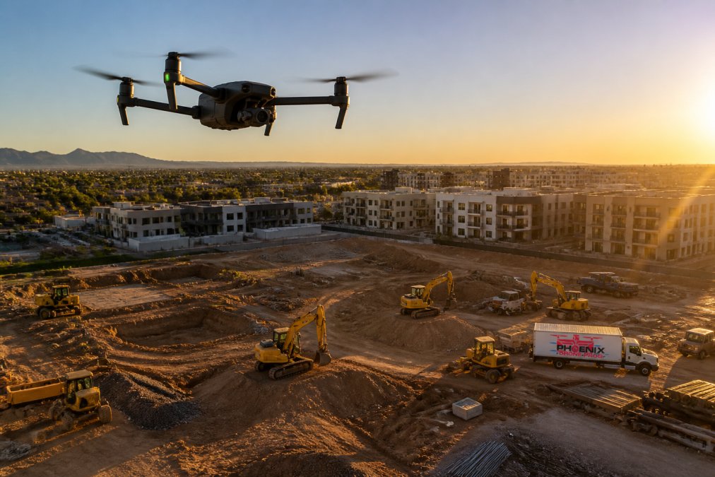
Point clouds are the foundation of all downstream processing. Each point represents a coordinate in three-dimensional space with color and intensity data attached. A dense point cloud from a construction site might contain millions of points with millimeter-level precision when proper ground control points are established (peer-reviewed research). From this point cloud, developers can generate orthomosaics (georeferenced 2D images), digital surface models (DSMs), and mesh reconstructions suitable for BIM integration or CAD import.
Accuracy depends on image overlap (typically 75-80% forward overlap and 60% side overlap), ground sampling distance (GSD, the real-world distance represented by each pixel), and ground control points (usgs.gov). A GSD of 2 centimeters means each pixel represents a 2-centimeter square on the ground, critical for detecting changes in elevation, material placement, and structural progress week to week.
Processing pipelines vary between cloud-based and desktop workstation approaches. Cloud processing distributes computational load across servers, handling massive datasets efficiently but introducing latency and data transfer overhead. Desktop processing keeps data local, reducing latency and ensuring sensitive site information stays in-house, a key concern for security-conscious construction firms.
Drone Photogrammetry Software for Construction: Integration and Workflow
Construction teams need seamless integration with existing project management and BIM workflows. The ideal setup involves automated capture scheduling, batch processing of imagery, and direct export to formats compatible with Revit, AutoCAD, or other standard construction tools. Developers building these workflows connect to APIs that handle authentication, job submission, and result retrieval.
The workflow begins with flight path planning. Modern APIs accept parameters like site boundaries, desired GSD, altitude, and image overlap, then calculate the optimal flight pattern accounting for wind conditions, battery constraints, and no-fly zones. Once the drone completes the mission, raw imagery uploads to a processing queue. Processing jobs can be monitored through polling or webhook callbacks, allowing developers to trigger downstream actions as soon as results are ready.
Phoenix Drone Pros has documented this workflow with construction clients managing multi-site projects. The bottleneck is rarely the drone capture itself; it's integrating the output into existing systems without manual intervention. APIs that return standardized data formats, GeoTIFF for orthomosaics, LAS or E57 for point clouds, OBJ or FBX for meshes, eliminate conversion steps and reduce turnaround time from days to hours.
For construction site progress documentation, this automation is transformative. Teams receive georeferenced 3D models automatically, compare this week's point cloud to last week's, calculate volumetric changes in stockpiles or excavation areas, and detect schedule deviations. Developers can build dashboards that surface this information to project managers without requiring specialized software training. If your team needs to get up to speed on drone operations and data integration, done flight training ensures your staff can manage captures and workflows confidently.
APIs and SDKs for 3D Mapping Integration
Developer-focused drone photogrammetry platforms expose capabilities through REST APIs and language-specific SDKs. A REST API handles job submission, monitoring, and result retrieval. An SDK wraps these endpoints in language-native libraries, reducing boilerplate and improving developer experience. Common languages include Python, JavaScript, and C#, the same stacks used in construction tech and facility management systems.
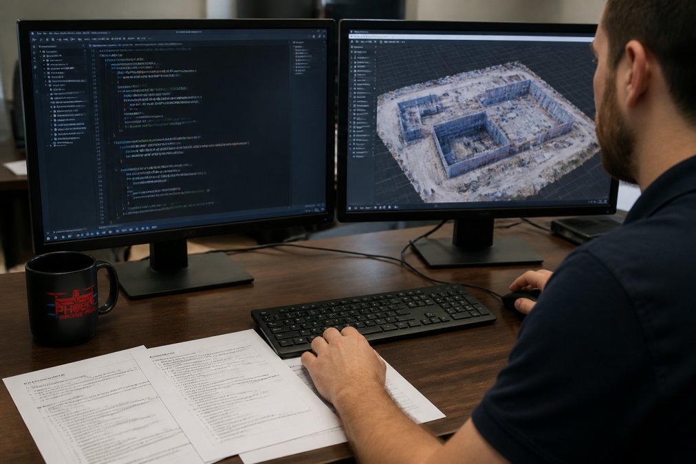
A typical API workflow: authenticate with credentials, submit a processing job with imagery URLs and parameters, poll the status endpoint until processing completes, and retrieve results in your chosen format. Sophisticated platforms support webhooks, allowing you to register a callback URL that receives notification when processing finishes, eliminating polling overhead and enabling event-driven architectures.
Data format interoperability is crucial for developer adoption. Point clouds should be available in standard formats like LAS, E57, or PLY. Orthomosaics should export as GeoTIFF with embedded geospatial metadata. Meshes should support OBJ, FBX, or glTF for rendering and CAD import. APIs that lock you into proprietary formats create friction; developers will favor platforms offering open standards.
SDKs should handle authentication transparently, provide clear error messages, and include retry logic for transient failures. A well-designed SDK makes it trivial to submit a job, monitor progress, and download results.
Cloud vs. Desktop Processing: Choosing Your Data Pipeline
Cloud processing and desktop processing represent fundamentally different trade-offs. Cloud platforms handle massive datasets without requiring expensive local hardware and scale automatically during peak demand. Desktop workstations keep data local, reduce latency, ensure data privacy, and avoid recurring subscription costs. The right choice depends on project requirements, data sensitivity, and infrastructure constraints.
Cloud processing excels when processing dozens of sites monthly or dealing with datasets too large for local storage. A cloud platform can process a 10-gigabyte imagery set in 2-4 hours, distributing work across multiple machines. The API-first design makes integration into automated workflows easy. The downside: data travels over the internet, introducing latency and potential security concerns. For sensitive construction sites or proprietary designs, this may be unacceptable. professional drone photography.
Desktop processing keeps everything local. A modern workstation with a GPU can process a moderate dataset in 4-8 hours. This approach suits firms processing a handful of large projects annually or operating where data cannot leave the facility. The trade-off is upfront hardware investment and the need for technical staff to manage processing queues.
Many organizations adopt a hybrid approach: use cloud processing for routine progress documentation and desktop processing for sensitive projects. APIs supporting both deployment models give you this flexibility. Some platforms offer edge computing options, processing nodes deployed on-site, combining cloud scalability with data locality.
For construction site progress documentation, the decision hinges on frequency and sensitivity. Weekly progress captures across multiple sites? Cloud processing scales effortlessly. Monthly captures of a single proprietary facility? Desktop processing keeps data in-house.
Construction Site Progress Documentation Best Practices
Construction site progress documentation requires consistent methodology, clear metadata, and automated comparison workflows. Establish a baseline model early in the project, captured before significant work begins, to serve as the reference for all future comparisons. Every subsequent capture should use identical flight parameters: same altitude, same GSD, same image overlap. Consistency enables accurate change detection and volumetric calculations.
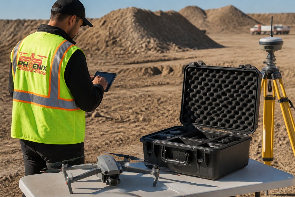
Ground control points (GCPs) are essential for survey-grade accuracy. GCPs are marked positions on the ground with known coordinates, typically established by a surveyor. Drones capture these GCPs in imagery, and processing software uses them to georeference the entire model. Without GCPs, models can drift slightly with each capture. With GCPs, accuracy typically reaches 2-5 centimeters, sufficient for detecting meaningful progress.
Metadata discipline is equally important. Record the capture date, time, weather conditions, flight altitude, GSD, and any site changes in a structured log. APIs should allow you to attach custom metadata to each job, making it queryable later.
Automated comparison workflows detect changes between sequential captures. Point cloud differencing algorithms measure the distance between corresponding points in two clouds, identifying areas of growth, excavation, or material placement. Volumetric calculations estimate how much earth was moved or material stockpiled. Developers can build dashboards that surface these metrics to project managers, eliminating manual review cycles.
Documentation frequency depends on project phase. Early-stage excavation and foundation work benefits from weekly captures. Later phases might require monthly captures. Frequency should align with project milestones and decision-making cycles.
FAA Part 107 Requirements for Mapping Operations
The FAA's Part 107 regulations govern commercial drone operations in the United States. Any drone 3D mapping work conducted for compensation must comply with these rules. Remote pilots must hold a Part 107 certificate, obtained by passing a written knowledge test and demonstrating flight competency (faa.gov). The certificate requires recurrent training every 24 months.
Part 107 operations are restricted to daylight hours, visual line-of-sight (VLOS) control, and altitudes below 400 feet above ground level. Flights over people are prohibited unless they're directly participating in the operation or sheltered by a structure. Night operations and beyond-visual-line-of-sight (BVLOS) flights require specific FAA waivers, a process that can take weeks or months.
For construction site documentation, these restrictions typically pose no problem. Sites operate during daylight, flights remain within VLOS, and 400-foot altitude ceilings are sufficient for most progress documentation. Developers building automated workflows should account for these constraints when planning flight paths.
Insurance requirements vary by jurisdiction and client, but most construction firms require drone operators to carry liability coverage. Phoenix Drone Pros maintains full insurance and Part 107 certification, ensuring compliance and protecting clients from liability.
Open-Source vs. Proprietary Engines: Cost and Capability Trade-offs
The photogrammetry landscape includes both open-source and proprietary processing engines. Open-source options like OpenDroneMap provide transparency, customization flexibility, and zero licensing costs. Proprietary platforms like Pix4D or DroneDeploy offer optimized performance, advanced features, and commercial support. The choice involves balancing cost, capability, and operational complexity.
Open-source engines excel for organizations with strong technical teams and specific customization needs. You control the source code, can optimize for your hardware, and avoid vendor lock-in. The trade-off is responsibility for deployment, maintenance, and troubleshooting. Processing performance may lag proprietary engines on large datasets.
Proprietary engines optimize for speed and accuracy through years of algorithm refinement. They typically offer cloud-based processing, eliminating local infrastructure requirements. The cost is subscription-based, ranging from hundreds to thousands of dollars monthly depending on processing volume. Vendor lock-in is a concern; migrating to a competitor requires significant effort.
For construction site progress documentation at scale, proprietary engines often make financial sense. The time savings and reliability justify the subscription cost. For smaller operations or research applications, open-source engines provide a compelling alternative. Developers should evaluate engines based on API maturity, data format support, and processing performance.
Drone 3D mapping for developers opens possibilities that end-user software cannot match. By accessing raw point clouds, orthomosaics, and mesh data through APIs and SDKs, you build automated workflows that transform construction progress documentation, real estate assessment, and facility management. The choice between cloud and desktop processing, open-source and proprietary engines, and the integration of ground control points for survey-grade accuracy shapes your data pipeline.
At Phoenix Drone Pros, we've helped construction teams and property managers integrate drone data into their existing systems. Our FAA-certified pilots and 10+ years of commercial experience mean your captures are accurate, compliant, and ready for integration. Whether you need weekly progress documentation, thermal inspections, or specialized aerial assessment, we deliver data that feeds directly into your workflows. Schedule a consultation to discuss how drone 3D mapping can accelerate your next project.
Frequently Asked Questions
What is the difference between LiDAR and photogrammetry for drone 3D mapping?
Photogrammetry reconstructs 3D scenes from overlapping aerial images using AI-driven algorithms to create point clouds and mesh models. LiDAR uses laser pulses to measure distance directly. Photogrammetry produces richer color and texture data, making it ideal for visual assets and BIM integration. LiDAR excels at penetrating vegetation and delivering survey-grade accuracy in dense environments. Developers often combine both approaches for comprehensive spatial data capture.
How can I integrate drone 3D mapping data into my construction management platform?
Most professional photogrammetry platforms offer REST APIs and SDKs that allow you to submit image sets, retrieve processed point clouds in standard formats (LAZ, E57, OBJ), and automate volumetric calculations. Store georeferenced orthomosaics and digital surface models in your cloud infrastructure. Use coordinate system transformation libraries to align drone-captured data with existing CAD files and site surveys. Implement real-time rendering of mesh models within your web or desktop application for stakeholder communication.
What FAA Part 107 requirements apply to commercial drone 3D mapping operations?
Part 107 requires a Remote Pilot in Command (Part 107 certificate) for any commercial drone flight, including mapping missions. Operations must remain within visual line of sight, below 400 feet AGL, and outside controlled airspace without a waiver. For construction site progress documentation, you need airspace authorization if flying near airports. Insurance coverage is mandatory for commercial operations. Documentation of flight plans and ground control point surveys supports regulatory compliance and data accuracy claims.
Should I use cloud-based or desktop processing for 3D mapping workflows?
Cloud processing scales effortlessly for large projects and reduces hardware costs, but introduces latency and data transfer overhead. Desktop workstations offer faster iteration for smaller datasets and keep sensitive data on-site. Edge computing hybrid approaches process raw imagery locally, then push refined point clouds to the cloud for storage and collaboration. For construction site progress documentation with weekly updates across multiple projects, cloud pipelines reduce bottlenecks. For real-time volumetric calculations on-site, desktop or edge processing is more responsive.
This article was written using GrandRanker