 listicle
Best Drone for Construction Site Mapping: 7 Top Picks
Table of Contents
- Quick Comparison: Best Drones for Construction Site Mapping
- How We Evaluated These Construction Mapping Drones
- 1. DJI Mavic 3 Enterprise: Best Overall for Daily Site Progress
- 2. Wingtra Ray: Best Fixed-Wing VTOL for Large Sites
- 3. DJI Matrice 400 RTK: Best for Survey-Grade Volume Analysis
- 4. DJI Matrice 300 RTK with L2: Best for LiDAR and 3D Modeling
- 5. Autel EVO II Pro: Best Budget Option for Overhead Photos
- 6. senseFly eBee X: Best for Large-Area Topographic Surveys
- Matching the Right Drone to Your Workflow
- Frequently Asked Questions
Last Updated: September 11, 2026
Quick Comparison: Best Drones for Construction Site Mapping
The best drone for construction site mapping depends on your site size, accuracy needs, and budget. For most teams, the DJI Mavic 3 Enterprise offers the strongest balance of portability and RTK precision. This guide breaks down seven top picks, from compact quadcopters to fixed-wing survey platforms.
| Drone | Best For | Positioning | Starting Price |
|---|---|---|---|
| DJI Mavic 3 Enterprise | Daily progress monitoring | RTK | Contact for pricing |
| Wingtra Ray | Large sites | RTK/PPK | Contact for pricing |
| DJI Matrice 400 RTK | Volume analysis | RTK | $10,450 |
| DJI Matrice 300 RTK with L2 | LiDAR and 3D modeling | RTK | Contact for pricing |
| Autel EVO II Pro | Budget overhead photos | Non-RTK | Contact for pricing |
| senseFly eBee X | Topographic surveys | PPK | Contact for pricing |
A common mistake is buying for maximum specs instead of your actual workflow. A compact RTK quadcopter that flies weekly beats a fixed-wing platform that sits in its case.
How We Evaluated These Construction Mapping Drones
Every platform in this guide was scored against the deliverables a construction team actually has to hand over: an orthomosaic, a digital surface model (DSM), a point cloud, and a stockpile volume report. Spec sheets do not tell you whether a drone can produce those files on a deadline, so we weighted the criteria below in the order that affects a real project schedule.
Spatial accuracy (highest weight). We looked at whether the platform achieves absolute accuracy through RTK or PPK rather than relying on ground control points alone. In practice, an RTK- or PPK-enabled aircraft can hold roughly 1-3 cm horizontal and 2-5 cm vertical accuracy when flown with proper overlap, which is the range most civil and sitework teams need for cut/fill and volume reporting (usgs.gov). Non-RTK aircraft typically land in the decimeter range and require more GCPs to tighten up.
Ground sample distance (GSD). GSD is the real-world size of one pixel on the ground, and it drives whether you can see a rebar grid or just a building footprint. A common construction target is 1 cm/px or finer for detail work and 2-3 cm/px for broad progress mapping. We noted the flight altitude each platform needs to hit those numbers, because lower altitude means more passes and shorter effective coverage.
Coverage per battery. This is the criterion that quietly decides whether a drone is practical. A multi-rotor flying 30-40 minutes may cover 40-150 acres per flight depending on altitude and overlap, while a fixed-wing VTOL can cover several hundred acres in a single sortie (faa.gov). We report endurance in minutes and coverage in acres so you can match the platform to site size instead of guessing.
Payload flexibility. We scored whether the airframe accepts RGB, multispectral, or LiDAR sensors, and whether swapping them requires a new aircraft or just a new gimbal. Modular payloads matter because a team that starts with photogrammetry often adds LiDAR later for vegetation-penetrating terrain models.
Workflow fit and portability. Crews move between sites, so we weighed setup time, case size, and whether the aircraft needs a runway, catapult, or open launch area. A platform that takes 20 minutes to assemble loses to one that deploys in three, even if the slower one has better specs.
Price and total cost of ownership (lowest weight). Purchase price is only part of the number. We considered sensor cost, spare batteries, software subscriptions, and the processing hardware you will need to turn raw captures into deliverables. Price was weighted last because the cheapest airframe is expensive if it cannot produce a survey-grade model.
For teams weighing a purchase, FAA Part 107 resources for commercial operators is the starting point before any hardware decision, since commercial mapping flights fall under Part 107 rules and require a remote pilot certificate.
1. DJI Mavic 3 Enterprise: Best Overall for Daily Site Progress
The Mavic 3 Enterprise is the best drone for construction site mapping when you need a portable unit that deploys in minutes. Its mechanical shutter prevents motion blur, and an RTK module delivers centimeter-level positioning for accurate orthomosaic output.
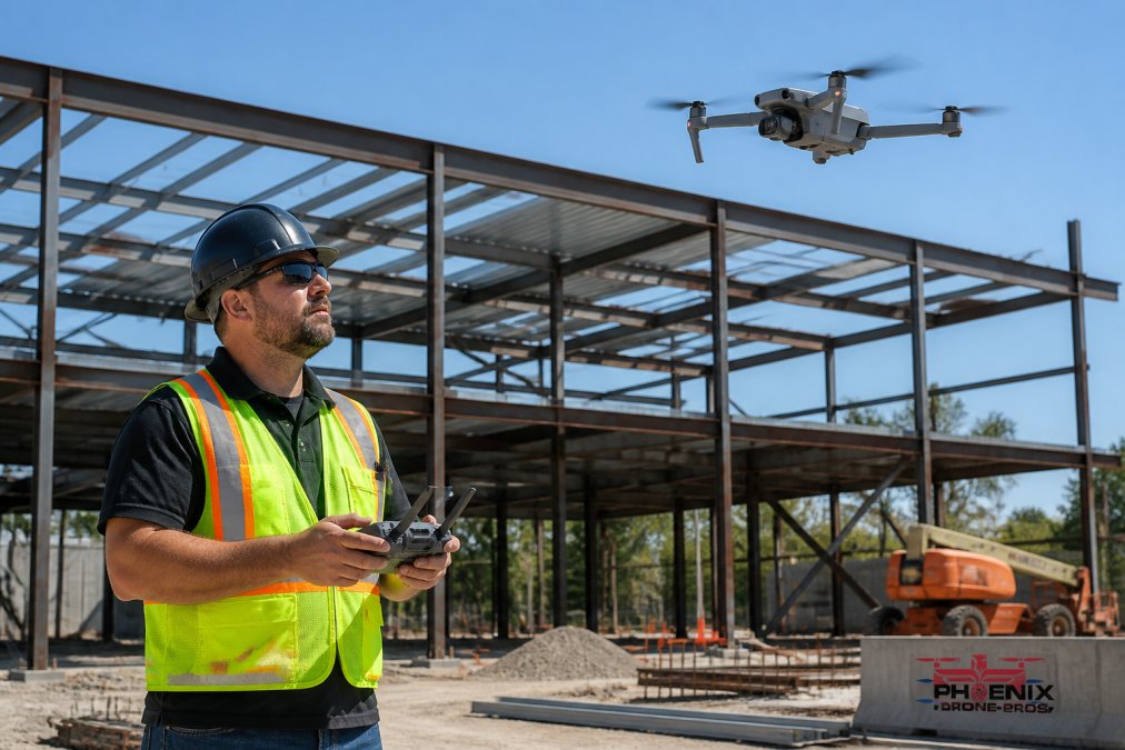
The 4/3-inch CMOS wide camera captures high-resolution imagery suitable for photogrammetry and site progress monitoring. Flight time is the tradeoff: shorter than fixed-wing alternatives, so plan your flight path accordingly.
Pros: Cost-effective for small to medium sites; fast deployment Cons: Limited endurance compared to fixed-wing models
2. Wingtra Ray: Best Fixed-Wing VTOL for Large Sites
Wingtra Ray is the pick for extensive sites where coverage efficiency decides the job. Vertical takeoff and landing means no runway or launch catapult, and RGB cameras up to 61 megapixels produce sharp imagery across large acreage.
It supports multispectral and LiDAR payloads, making it flexible for terrain modeling, volumetric analysis, and topographic survey work. The higher entry cost reflects its coverage speed.
Pros: Superior coverage on large sites; high-accuracy output Cons: Higher cost than multi-rotor drones
3. DJI Matrice 400 RTK: Best for Survey-Grade Volume Analysis
The Matrice 400 RTK is built for survey-grade work. It carries Zenmuse LiDAR and RGB sensors, and RTK positioning supports accurate stockpile volume measurement and site modeling.
At $10,450 as a starting price, this is a serious investment. The modular design accepts multiple high-end sensors, so one platform covers several jobs.
Pros: Modular sensor support; strong in demanding conditions Cons: Significant investment for the full sensor suite
4. DJI Matrice 300 RTK with L2: Best for LiDAR and 3D Modeling
Pair the Matrice 300 RTK with the L2 LiDAR sensor and you get dense point clouds that penetrate vegetation and terrain in a way photogrammetry cannot. Photogrammetry reconstructs surfaces from overlapping photos, so it struggles under tree canopy and on uniform surfaces like fresh asphalt or water. LiDAR fires laser pulses and measures returns directly, which is why it is the right tool for topographic survey under cover, corridor mapping, and as-built verification. AI tools for contractors.
The L2 combines a laser scanner with a high-accuracy inertial measurement unit (IMU) and a survey-grade GNSS receiver. That combination is what allows the system to georeference each point in flight, so the resulting cloud lands in real-world coordinates without a dense network of ground control points. On a typical site, that can cut field time substantially compared with a photogrammetry-only workflow that depends on GCPs.
The part most guides skip: what happens after the flight. A LiDAR mission produces far more data than a photo set. A single sortie over a mid-size site can generate several gigabytes to tens of gigabytes of raw returns, and the processed point cloud can be larger still. Turning that into a usable surface model is a workstation problem, not a drone problem.
A realistic processing setup for construction-scale LiDAR looks like this:
- CPU: a modern multi-core processor, ideally 8 cores or more, since point cloud classification and meshing scale with core count.
- RAM: 32 GB is a practical floor; 64 GB or more is common for large sites and for running classification alongside modeling software.
- GPU: a discrete graphics card with a healthy amount of VRAM helps with visualization and with photogrammetry steps if you also process RGB.
- Storage: fast NVMe solid-state storage for active projects plus a large drive or NAS for archiving raw and processed data. Point clouds are not small, and you will keep them for the life of the project.
The software side matters just as much. Most teams run a dedicated LiDAR processing package for classification and surface generation, then export a LAS or LAZ point cloud and a DSM into their design or BIM environment. Classification, which separates ground from vegetation and structures, is the step that most affects whether your volume and terrain numbers hold up, and it is the step that benefits most from a trained operator.
Where this platform fits. Choose the Matrice 300 RTK with L2 when your deliverables require vegetation-penetrating terrain models, corridor or linear infrastructure mapping, or as-built verification against a design surface. Skip it if your work is flat, open, and purely visual, because you will pay a processing and training premium for capability you will not use.
Pros: Excellent point cloud density; reliable in complex conditions; survey-grade georeferencing without dense GCP networks Cons: Requires specialized training for processing; demands a capable workstation and disciplined data management
5. Autel EVO II Pro: Best Budget Option for Overhead Photos
The EVO II Pro is the budget-conscious choice. A 6K camera captures detailed high-resolution imagery, and the foldable design travels easily. Omnidirectional obstacle avoidance adds a safety margin.
The limitation is clear: no native RTK integration, so it suits overhead photos and visual documentation rather than survey-grade mapping.
Pros: Lower price point; high-resolution imaging Cons: Lacks native RTK for survey work
6. senseFly eBee X: Best for Large-Area Topographic Surveys
The eBee X is a professional fixed-wing platform built for rapid data collection over large areas. Extended flight endurance covers more ground per mission, and modular camera options include RGB and multispectral.
Fully automated flight planning software simplifies mission setup. It requires open space for hand-launching, which rules out tight urban sites.
Pros: Highly efficient for large acreage; proven in surveying Cons: Needs open space for hand-launching
Matching the Right Drone to Your Workflow
Choosing the best drone for construction site mapping comes down to matching hardware to your actual jobs. Small infill projects rarely justify a fixed-wing platform; large topographic surveys rarely suit a short-endurance quadcopter.
For teams that would rather not buy and maintain hardware at all, Phoenix Drone Pros provides FAA-certified, fully insured pilots with over a decade of commercial experience, covering reliable construction progress documentation and aerial inspections.
Frequently Asked Questions
What is the best drone for site surveying?
There is no single best drone for every site. For daily progress on small to medium sites, the DJI Mavic 3 Enterprise offers RTK positioning and a mechanical shutter in a portable package. For large-area topographic surveys, fixed-wing VTOL models like the Wingtra Ray cover more ground per flight. For survey-grade volumetric analysis and LiDAR point clouds, the DJI Matrice 400 RTK and Matrice 300 RTK with L2 are the heavier-duty options. Match the drone to your site size, accuracy needs, and budget.
Do I need an FAA Part 107 license for construction site mapping?
Yes. Any commercial drone operation, including construction site mapping, requires a Remote Pilot Certificate under FAA Part 107. You must be at least 16 years old, pass the aeronautical knowledge test, and hold a current certificate. You also need to register the drone if it weighs over 0.55 pounds. Flying over active construction sites often requires additional coordination, such as notifying site managers and checking for temporary flight restrictions.
How much does a mapping drone cost?
Mapping drone prices vary widely. The DJI Matrice 400 RTK starts at $10,450 for the base platform, and sensor suites like LiDAR add significantly to that. Compact enterprise drones like the Mavic 3 Enterprise cost less but still require an investment. Fixed-wing options like the Wingtra Ray carry a higher entry cost. For many construction firms, hiring an FAA-certified drone service provider for mapping and progress documentation is more cost-effective than buying and maintaining equipment.
What features are essential for a construction site mapping drone?
Look for RTK or PPK positioning for centimeter-level accuracy, a mechanical shutter to avoid motion blur during mapping flights, and enough flight time to cover your site in one mission. High-resolution cameras (at least 20MP) and support for LiDAR or multispectral payloads matter for detailed terrain modeling and volumetric analysis. Autonomous flight planning and compatibility with photogrammetry software for orthomosaic and point cloud generation are also critical.
Can I use a non-RTK drone for construction mapping?
You can, but accuracy suffers. Non-RTK drones rely on GPS alone, which typically provides meter-level positioning. For stockpile volume measurement, topographic surveys, or BIM integration, that is not precise enough. RTK drones use a base station or network correction to achieve centimeter-level accuracy, which is why they are standard for survey-grade work. If you only need visual progress photos, a non-RTK drone may suffice, but for measurable data, RTK is worth the investment.
Buying a drone is only half the equation. Flight planning, data processing, and consistent deliverables are where most teams struggle, and that is exactly where Phoenix Drone Pros removes the burden. Our team handles site progress documentation, aerial inspections, and detailed property views so your project stays on schedule without added overhead. Get started with Phoenix Drone Pros and turn every flight into documentation your team can actually use.