 listicle
Drone Roof Inspection Software for Damage Analysis
Table of Contents
- What Drone Roof Inspection Software Does
- AI-Powered Roof Damage Detection and Automation
- 3D Modeling, Orthomosaics, and Photogrammetry Workflows
- Thermal Imaging for Moisture and Leak Detection
- FAA Part 107 Roof Inspection Requirements and Compliance
- Drone Roof Inspection Report Templates and Data Delivery
- Choosing the Right Software for Your Workflow
- Frequently Asked Questions
Last Updated: September 22, 2026
What Drone Roof Inspection Software Does
Drone roof inspection software transforms raw aerial footage into actionable damage assessments. It's the bridge between flight data and decisions that matter, insurance claims, repair estimates, structural analysis.
The software handles the heavy lifting: stitching images into orthomosaics, generating 3D models, detecting damage patterns, and organizing findings into shareable formats that adjusters, contractors, and property managers use.
After a drone captures imagery, the software processes that data into georeferenced models, thermal overlays, and annotated reports, quantifying roof pitch, square footage, damage location, and severity classification.
Platforms vary in emphasis: some prioritize speed, others AI-powered defect detection, others insurance workflow integration. Your choice depends on your role, contractor, adjuster, or facilities manager.
The software creates audit trails through flight data, timestamps, and processing logs, essential for commercial work.
AI-Powered Roof Damage Detection and Automation
Machine learning algorithms identify roof defects by scanning high-resolution imagery and flagging missing shingles, ponding water, hail damage, and thermal anomalies automatically.
Automation highlights problem areas instead of requiring manual review of hundreds of images, surfacing missing shingles, moisture patterns, and structural concerns with precise measurements.
Automation identifies damage candidates; trained inspectors validate findings and determine severity. Automation removes tedium, not expertise.
Detection quality depends on image resolution and algorithms, high-resolution imagery and advanced models catch subtle damage; lower-tier platforms may miss issues or produce false positives.
Real-world performance varies: DroneDeploy integrates thermal imaging for leak identification, Pix4Dinspect uses advanced algorithms for defect annotation, and EagleView Assess combines high-resolution capture with insurance-trained detection.
Benefits include faster claims processing, quicker contractor quotes, and maintenance alerts before minor issues escalate.
3D Modeling, Orthomosaics, and Photogrammetry Workflows
Photogrammetry extracts spatial data from drone imagery, converting video flights into point clouds, meshes, and orthomosaics (bird's-eye views with uniform scale).
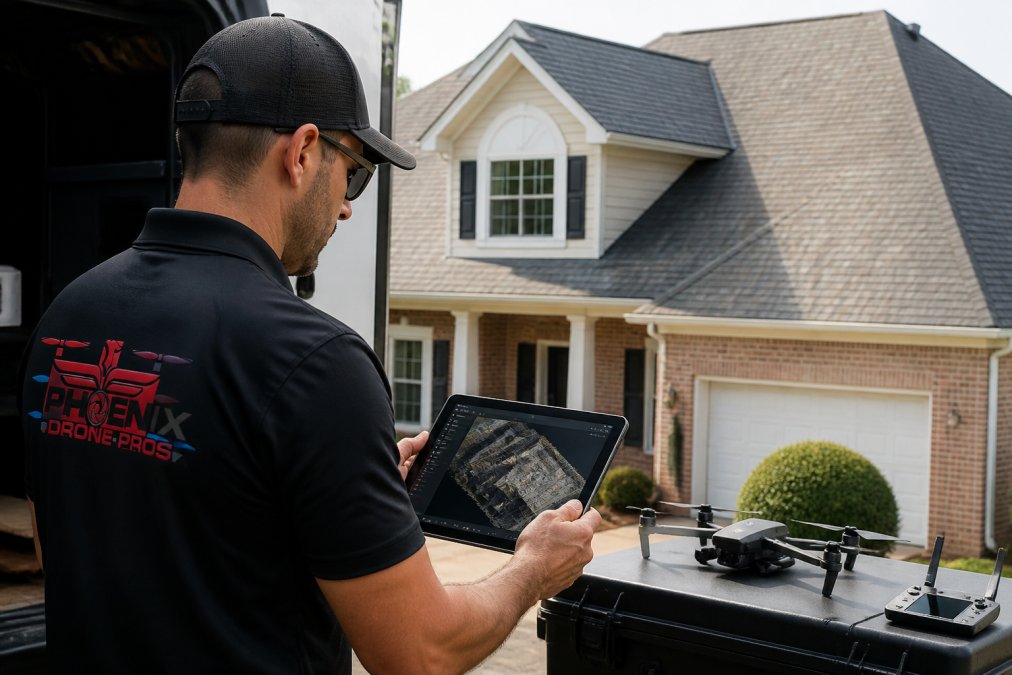
Flight planning uses automated paths to ensure consistent overlap and ground sampling distance (pixel size). A residential roof at 200 feet altitude with 80% overlap yields 1-2 centimeter resolution, sufficient for individual shingles and small defects.
Raw images feed into photogrammetry software, which identifies matching points, calculates camera positions, and builds 3D models. SkyeBrowse converts video into models in hours; WebODM processes locally; RealityCapture handles complex geometries.
Local vs. Cloud Processing: Hardware and Cost Trade-offs
Where processing occurs, on your hardware or in the cloud, fundamentally changes workflow economics and data control.
Cloud-based processing (DroneDeploy, Pix4Dinspect, EagleView Assess) offloads computation to vendor servers. Advantages: no hardware investment, automatic scaling, results within hours. Disadvantages: recurring costs ($300-$1,500 monthly), data transmission overhead, internet dependency. For 5-10 inspections monthly, cloud eliminates workstation investment; for 30+ monthly, subscription costs often exceed local hardware costs.
Local processing (WebODM, RealityCapture, Metashape) runs on your computers. Advantages: one-time cost, no recurring fees, data privacy, no upload delays. Disadvantages: significant upfront hardware investment and configuration burden.
Local processing hardware requirements scale with dataset size:
- Small residential roofs (500-1,000 images, ~2 GB raw data): Intel i7/Ryzen 7 processor, 16 GB RAM, NVIDIA RTX 3060 GPU (8 GB VRAM). Processing time: 2-4 hours. Estimated hardware cost: $1,200-$1,800.
- Large commercial roofs or complex geometries (2,000-4,000 images, ~8-16 GB raw data): Intel i9/Ryzen 9 processor, 32-64 GB RAM, NVIDIA RTX 4070 or A5000 GPU (12-24 GB VRAM). Processing time: 6-12 hours. Estimated hardware cost: $3,500-$6,000.
- Enterprise-scale operations (10,000+ images, 40+ GB raw data): Dual-GPU workstations with 128 GB RAM. Processing time: 24-48 hours. Estimated hardware cost: $8,000-$15,000.
GPU selection matters most: NVIDIA CUDA-based GPUs accelerate photogrammetry 5-10× faster than CPU-only processing. A workstation with RTX 3060 processes residential roofs in 2-3 hours versus 12-16 hours without GPU.
Hybrid approaches use cloud for fast client delivery and local processing for detailed analysis, or cloud for insurance claims and local for contractor estimates.
Output Formats and Measurement Workflows
Outputs include digital surface models (elevation), orthomosaics (georeferenced 2D), point clouds (3D coordinates), and mesh models (3D visualization).
Ground sampling distance matters: 1-centimeter captures individual shingles; 5-centimeter misses fine detail. Professional tools let operators specify target distance before flight.
3D data feeds into measurement tools: roof pitch calculates automatically, square footage integrates with boundaries, and penetrations appear as distinct features. Some platforms automate penetration detection; others require manual annotation.
A processed inspection generates 500 MB-2 GB of output files; 50 annual inspections require 25-100 GB storage. Cloud platforms include storage; local workflows require external drives or NAS.
Thermal Imaging for Moisture and Leak Detection
Thermal cameras reveal moisture, missing insulation, and air leaks by detecting heat patterns invisible to regular sensors.
Thermal overlays on orthomosaics show moisture concentration and correlate anomalies with structural features, valleys, penetrations, open deck.
Moisture detection requires no roof access or destructive testing; thermal cameras highlight subsurface patterns.
DroneDeploy combines thermal imaging with AI analysis; EagleView Assess integrates thermal data into damage assessment; Hammer Missions incorporates thermal analysis into structural evaluation.
Thermal imaging works best on clear days with temperature differentials; cloud cover, rain, or thick insulation reduce effectiveness. Thermal data guides investigation but doesn't diagnose every issue.
FAA Part 107 Roof Inspection Requirements and Compliance
Commercial drone operations fall under FAA Part 107 regulations governing who can fly, where, altitude, and documentation. Compliance is foundational for roof inspections.
Part 107 requires a Remote Pilot Certificate with knowledge tests on airspace, weather, regulations, and procedures. Operators must stay current on regulatory changes.
Flight operations require visual line of sight, 400-foot maximum altitude, restrictions on operations over people, and waivers for night flights.
Flight logs and imagery timestamps create audit trails protecting operators and clients, expected by insurance companies and legal proceedings.
Local regulations may require permits, airspace clearance, and property owner consent. Professional operators confirm requirements before each flight.
Drone Roof Inspection Report Templates and Data Delivery
Reports transform raw data into actionable intelligence through templates that standardize findings and speed delivery.
Effective templates include executive summaries, damage inventories with location and severity, measurements, thermal data, and 3D models for stakeholder exploration.
Delivery formats vary: contractors need CAD measurements and material lists, adjusters need claim-standard reports, property managers need maintenance recommendations.
Cloud-based delivery enables remote access with 3D models in browsers, visible annotations, and location-specific comments, accelerating decisions.
Standardized reporting aligns with insurance workflows: EagleView Assess matches claim requirements, DroneDeploy matches adjuster expectations, Hammer Missions generates structural reports.
Integration with Business Software: CRM, Project Management, and Accounting
Inspection data must flow into existing business systems, where most drone software falls short.
CRM and project management integration determines whether findings stay siloed or become actionable tasks.
Contractors need inspection data to auto-populate job records and trigger tasks. Most drone software exports static PDFs; integration-capable platforms (DroneDeploy via Zapier) push summaries directly into CRM fields.
Project management platforms benefit from automated task creation. Few platforms do this natively; WebODM and open-source tools offer API access for custom integration.
Accounting and estimation software integration affects quote accuracy. Platforms like DroneDeploy and Pix4Dinspect support CSV export; integration with specific estimating tools varies by vendor.
Insurance claim workflows require standardized formats. EagleView Assess integrates directly with major platforms; DroneDeploy requires manual upload; smaller platforms create friction through manual re-entry. Standardizing these inputs across international jurisdictions remains a complex challenge, as detailed in our drone survey guide.
Practical Integration Scenarios
Scenario 1: Roofing contractor workflow A contractor using HubSpot and Asana must manually copy findings into both systems (20-minute overhead per inspection). DroneDeploy's Zapier integration can partially automate this with technical setup.
Scenario 2: Insurance adjuster workflow Adjusters manually enter measurements and damage codes into Xactimate, introducing errors and doubling processing time. EagleView Assess integrates with Xactimate; most others do not.
Scenario 3: Facilities management workflow Property managers manually create work orders from inspection reports, missing proactive repair opportunities. Few drone platforms integrate with CMMS systems.
Choosing Software Based on Integration Needs
If your business relies on specific software, verify integration before selecting a drone platform:
- HubSpot users: DroneDeploy (via Zapier) or custom API development with WebODM.
- Xactimate users: EagleView Assess (native integration) or manual report upload for other platforms.
- Asana/Monday.com users: Zapier connectors available for DroneDeploy; most others require manual task creation.
- Custom or legacy systems: WebODM and open-source platforms offer API access; commercial platforms rarely do.
Integration gaps are often the hidden cost of drone software selection. A platform that saves 2 hours on processing but adds 1 hour of manual data entry to your CRM is a net loss. Evaluate total workflow time, not just processing speed.
The practical advantage: faster approvals, fewer clarification requests, and reduced administrative overhead. Adjusters process claims without follow-up questions.
Choosing the Right Software for Your Workflow
Software selection depends on three factors: your role, your volume, and your technical capacity.
| Factor | Best For | Recommended Approach |
|---|---|---|
| Speed & Simplicity | Contractors, small teams | SkyeBrowse, DJI Pilot 2 |
| Enterprise Features | Large roofing companies, adjusters | DroneDeploy, Pix4Dinspect |
| Precision & Detail | Engineers, detailed analysis | RealityCapture, Hammer Missions |
| Budget-Conscious | Solo operators, learning phase | WebODM, GAF QuickMeasure |
| Insurance Workflows | Claims adjusters | EagleView Assess, DroneDeploy |
Frequently Asked Questions
What features should I look for in drone roof inspection software?
Prioritize automated damage detection, 3D modeling capabilities, and thermal imaging integration. The software should generate CAD-ready reports, handle orthomosaic creation, and integrate with your existing workflow tools. Verify that it supports your drone hardware and offers cloud-based processing to reduce local hardware demands. Look for solutions that produce georeferenced data and standardized reporting templates for insurance adjusters or contractors.
Does drone roof inspection software automatically detect roof damage?
Many modern platforms use machine learning algorithms to identify common damage types like missing shingles, hail damage, and ponding water. However, detection accuracy varies by software and image quality. AI-powered systems work best with high-resolution imagery and proper flight patterns. Manual review by a trained inspector remains the industry standard for critical assessments, especially for complex roof geometries or subtle structural issues.
How much does drone roof inspection software cost?
Pricing models vary widely. Costs depend on processing speed, AI features, storage capacity, and reporting tools. Contact providers directly for quotes tailored to your inspection volume and required features.
What are the FAA Part 107 requirements for roof inspections with drones?
Operators must hold an FAA Part 107 Remote Pilot Certificate, maintain visual line of sight, stay below 400 feet, and avoid flying over people or populated areas. Daylight-only operations are required unless a waiver is obtained. Inspections on private residential property typically fall under Part 107 rules. Always verify local zoning restrictions and obtain property owner consent. Professional operators like Phoenix Drone Pros maintain full FAA certification and insurance to ensure compliance and liability protection.