 comparison
Is Drone Photography Worth It for Small Listings?
Quick Summary
Drone photography is worth it for a small listing only when the outdoor features are doing real selling work. Homes displayed with aerial shots are 68% more likely to sell, according to National Association of Realtors MLS data, but ground-level photos often suffice for small interiors.
- Homes displayed with aerial shots are 68% more likely to sell, per NAR MLS data.
- Basic drone photography packages typically range from $150 to $250.
- Listings with video receive 403% more inquiries than those without.
- Use aerial photos when a pool, large lot, waterfront or view is part of the value.
- For small interior-focused properties, start with ground-level media and add a drone only if justified.
Table of Contents
- Does Drone Photography Pay Off on a Small Listing?
- Real Estate Drone Photography Cost: What Small Listings Should Expect
- Benefits of Drone Photography for Real Estate Listings
- Drone Photography for Small Homes: When the Lot Carries the Listing
- When to Use Aerial Photos in a Property Listing
- Alternatives for Small or Urban Properties
- Booking Aerial Photos for Your Next Listing
- Frequently Asked Questions
Does Drone Photography Pay Off on a Small Listing?
Last Updated: November 2, 2026
Drone photography can be worth it for a small listing, but only when the outdoor features are doing real selling work. According to National Association of Realtors MLS listing performance data, homes displayed with aerial shots are 68% more likely to sell. That figure is a strong argument, yet it does not automatically apply to every compact lot or urban townhome.
At Phoenix Drone Pros, we look at the property first. If the lot, setting or views would be invisible from the street, the aerial shot earns its place. If the listing is a small interior with a tiny patio, ground-level photography often does the job for less money. Where a property's exterior or lot needs a hard-to-get angle, our team can also handle that through our drone real estate services and a Video Offering Memorandum, which packages aerial footage into a fuller marketing piece.
Is drone photography worth it for small listings? Usually only when the outdoor setting is a selling point.
Real Estate Drone Photography Cost: What Small Listings Should Expect
Basic drone photography packages typically range from $150 to $250, according to Vantage Aerial Works pricing guide. Pricing depends on property size, flight time, editing and delivery format, so treat that range as a starting point rather than a quote. You can compare real estate drone photography pricing before requesting a quote.
Hourly rates vary more widely. International Association of Certified Real Estate Agents cost analysis reports a national average hourly range of $102 to $367 for drone services. For a small listing, a short session on a single property usually costs less than a full-day shoot.
What actually moves a small-listing quote is rarely the square footage of the house. Most practitioners price on the flight plan: how many distinct shots the property needs, whether the pilot must fly at multiple altitudes to capture lot lines and views, and how much editing is required to correct exposure across a bright sky and a shaded yard. A quarter-acre lot with a pool and a view may take more flight time than a larger lot with nothing to show, because the pilot is positioning for several angles rather than one overhead frame.
Ask what the package includes before comparing dollar figures. A useful small-listing deliverable covers the stills, video and file formats your marketing plan requires. Confirm the turnaround time in writing, and ask whether the quote includes licensing for MLS use, social media and paid ads, or whether those are add-on fees.
Pricing for Phoenix Drone Pros depends on quantity, dates and delivery requirements. For current rates or a custom quote, contact Phoenix Drone Pros directly.
Watch out: a low headline price can hide a short shot list or a license that covers only the MLS, which forces a second purchase when the same images are needed for a brochure or a paid social campaign.
The article gives these starting cost figures for drone photography on a listing.
| Source | Figure | Note |
|---|---|---|
| Vantage Aerial Works pricing guide | $150 to $250 | Basic package starting point |
| IACREA cost analysis | $102 to $367 per hour | National average hourly range |
| Phoenix Drone Pros | Varies | Depends on quantity, dates and delivery |
Benefits of Drone Photography for Real Estate Listings
The clearest benefit is buyer attention. RubyHome real estate photography statistics reports that listings with video receive 403% more inquiries than those without. Aerial footage often forms part of that video package.
Aerial images also show what ground photos cannot. Browse drone real estate photography that sells to see how aerial shots look in practice. Lot lines, landscaping, privacy and the surrounding neighborhood all become visible in one frame. Buyers who scroll past interior-only listings tend to slow down when they see the full property.
Watch out: a dramatic aerial shot of an ordinary backyard can set expectations the house cannot meet. Keep the drone work honest and matched to what the buyer will see in person.
Drone Photography for Small Homes: When the Lot Carries the Listing
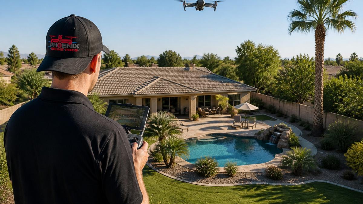
Small homes benefit most when the lot is part of the sale. PicAppoint real estate drone guide notes that even half-acre lots gain from overhead shots that show property lines, landscaping and privacy.
A compact condo on a shared lot rarely needs aerial work. A detached home with a usable yard, pool or view often does. The question is whether the outdoor space would influence a buyer's decision.
When to Use Aerial Photos in a Property Listing
Use aerial photos when the exterior, surroundings or views are part of the value. Large lots, waterfront access, pools and distinctive architecture all qualify. Amplifiles real estate photography pricing analysis points to these outdoor assets as the most consistent reasons drone work pays off.
Skip aerial work when the outdoor space is minimal. Pinnacle Real Estate Marketing guide makes the same point: for small interior-focused listings, ground-level media may be enough.
Before booking, check how the property is prepared for filming. Learn how to prepare a property for aerial filming so the shoot captures its best angles.
Alternatives for Small or Urban Properties
Urban and small properties often suit ground-level tools better, and the decision is easier when each alternative is compared on cost, effort and what it actually shows a buyer.
Ground-level exterior photography is the default. A wide-angle shot of the front elevation, a second angle from the side yard, and a close frame of the entry or patio cover most of what a small listing needs, and the cost is usually folded into a standard listing photo package. The limitation is height: a ground camera cannot show lot shape, roof condition or how the property sits relative to neighbors. Elevating the perspective to capture these missing details often requires a shift in budget, necessitating a careful evaluation of how real estate photography costs scale when moving beyond basic ground-level documentation.
Elevated pole shots are the middle option. A photographer raises a camera on a pole or monopod to roughly 10 to 15 feet, which clears fences and low landscaping without a flight. Pole shots can show a small backyard, a pool deck or a side yard in a single frame, and they avoid airspace and weather delays. They cannot match a drone at 100 feet, so they work best when the story is the yard itself rather than the surrounding area.
Floor plans and 2D or 3D tours serve a different purpose. For a compact condo or townhome where the interior is the product, a floor plan helps buyers understand layout and square footage, and a virtual tour lets them walk the space online. Neither shows the setting, so pair them with a ground-level exterior gallery rather than treating them as a substitute for aerial work.
A map overlay or a labeled site plan can communicate location and neighborhood context without any flight. This is often the cheapest way to answer the question a drone would answer for an urban listing: where is this property relative to parks, transit or a commercial district.
A simple decision rule helps. If the outdoor space is small and the neighborhood is dense, start with ground-level exterior photos plus a floor plan or tour, and add a pole shot only if the yard is a selling point. If the lot is larger, the view is open, or the property boundary is hard to read from the street, the drone earns its fee. Practical constraints such as airspace rules and neighbor privacy should be checked before any flight, and a pilot who knows the local airspace can tell you quickly whether a planned shot is even possible. If your team needs to build that local know-how, drone training from Phoenix Drone Pros covers flight operations and airspace basics.
Booking Aerial Photos for Your Next Listing
Book aerial photos when the outdoor setting is part of the sale, and plan the shoot around the property's best angles. Confirm that the photographer carries current insurance and certifications.
If your listing has a pool, large lot or view worth showing, aerial photography is likely worth the investment. For a small interior-focused property, start with ground-level media and add the drone only if the outdoor space justifies it.
Frequently Asked Questions
How much does real estate drone photography cost?
Pricing depends on the number of shots, the flight time, the editing required and whether video is included. For current rates on your property, request a quote from Phoenix Drone Pros, since pricing varies with the size of the job and delivery timeline.
Is drone photography worth it for a small real estate listing?
It is worth it when the outdoor space is a selling point, such as a half-acre lot, a view, a pool, waterfront access or landscaping that ground-level photos cannot show well. For a small interior-focused home with little exterior appeal, ground-level photography and a strong photo set may carry the listing without aerial imagery. Compare the added cost against what the outdoor features add to the listing before booking.
When do aerial photos help sell a property?
Aerial photos help most when buyers need to understand the property's boundaries, lot layout, privacy or surroundings. These figures describe listings in general, so judge whether your property has the outdoor features that make aerial views useful.
Do real estate agents need a drone license?
Commercial drone operators in the United States need to follow Federal Aviation Administration rules, which include certification for commercial operations. Ask any provider to confirm its certification and insurance before booking. Ask any provider to confirm its certification and insurance before the flight.