 comparison
Is Drone Pipeline Inspection Reliable? A 2026 Guide
Table of Contents
- How Drone Pipeline Inspection Works
- Drone Inspection Sensors and Their Detection Limits
- Drone Inspection Accuracy: What the Data Shows
- Pipeline Inspection Methods: Drones vs. Inline and Ground Patrols
- Pipeline Right-of-Way Monitoring with Drones
- Reliability Limitations and When Drones Fall Short
- The Verdict: Is Drone Pipeline Inspection Reliable?
- Frequently Asked Questions
Last Updated: October 16, 2026
How Drone Pipeline Inspection Works
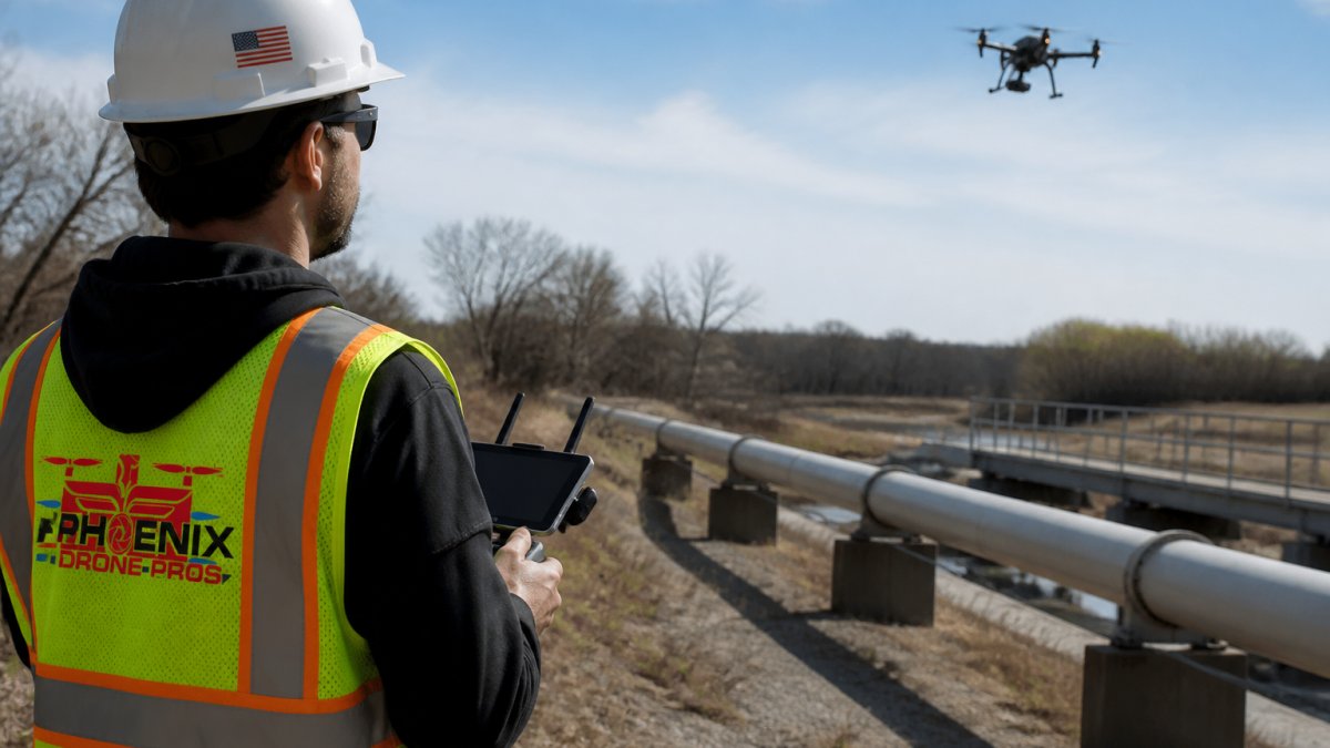
Drone pipeline inspection uses unmanned aerial vehicles equipped with high-resolution cameras and specialized sensors to survey pipeline corridors and identify potential issues. The process begins with flight planning, where operators map the pipeline route and establish waypoints for the drone to follow. During the flight, the drone captures continuous video and still imagery of the pipeline, right-of-way conditions, and surrounding terrain.
The workflow typically involves three stages: pre-flight preparation, data capture, and post-flight analysis. Before takeoff, the pilot reviews weather conditions, obtains necessary permits, and configures the drone's sensors and flight parameters. During the mission, the drone maintains a consistent altitude and speed to ensure image quality and coverage consistency.
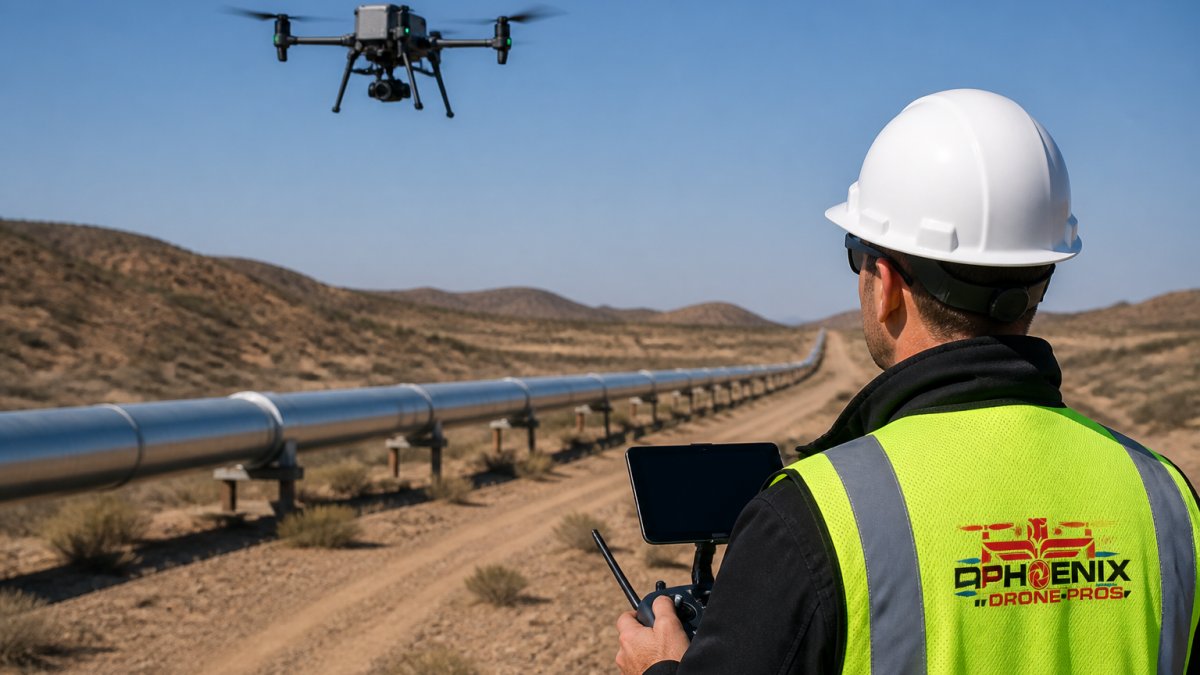
What makes drone pipeline inspection appealing is speed and accessibility. A pipeline section that once required days of ground-based patrol can be surveyed in hours. Operators can reach areas that are difficult or dangerous to access on foot, such as steep slopes, dense vegetation, or industrial facilities with restricted access.
However, this speed comes with important limitations. Drones operate within visual line of sight or, in some cases, beyond-visual-line-of-sight (BVLOS) with regulatory approval. Operators who want to maximize flight safety and data quality often benefit from Done flight training, which ensures pilots understand best practices for challenging environments and sensor operation.
Drone Inspection Sensors and Their Detection Limits
Modern drones carry multiple sensor types, each with specific capabilities and limitations. High-resolution RGB cameras capture visible-light imagery that shows surface conditions, vegetation encroachment, and obvious damage. Thermal imaging cameras detect temperature variations that may indicate leaks or subsurface issues. Some platforms include multispectral sensors that capture data across multiple light wavelengths, useful for vegetation analysis and environmental assessment.
The critical point: sensors capture data, but they do not automatically diagnose problems. A thermal anomaly might indicate a leak, or it might simply reflect ambient temperature variation. A discolored patch in the RGB imagery could signal corrosion, soil contamination, or normal weathering.
Specialized platforms exist for more advanced sensing. Some drones carry nondestructive testing probes that can assess pipeline defects including cracks, dents, corrosion, and insulation issues. These systems provide more diagnostic information than visual inspection alone, but they are more complex to operate and require trained personnel to interpret the results.
The detection limits are real. Drones cannot reliably identify small cracks or pinhole leaks that are not yet causing thermal or visual signatures. Buried or submerged pipelines are invisible to aerial inspection. Corrosion on the interior surface of the pipe cannot be detected from outside. Paint or coating obscures the underlying metal condition. These limitations do not make drone inspection worthless, they simply define what it can and cannot do.
Drone Inspection Accuracy: What the Data Shows
Accuracy in drone pipeline inspection depends heavily on what you are trying to detect and how you define accuracy. If the goal is to document overall corridor conditions and identify obvious defects, drone inspection performs well. Operators can reliably locate visible damage, vegetation issues, and surface anomalies. The high-resolution imagery provides a clear record of pipeline conditions at the time of the flight.
If the goal is to detect small defects, assess internal corrosion, or measure defect dimensions precisely, drone inspection alone is less reliable. Many operators combine drone data with ground inspection or inline inspection to verify findings and gather data that drones cannot provide. This layered approach, drone survey followed by targeted ground inspection, is more accurate than either method alone.
Real-world performance depends on sensor quality, environmental conditions, and operator skill. Professional-grade drones with high-resolution cameras and thermal sensors outperform consumer-grade platforms. Clear weather, good lighting, and moderate wind conditions produce better data than poor weather. Experienced operators plan flights to optimize image overlap, maintain consistent altitude, and capture multiple angles of critical sections.
The honest assessment: drone inspection excels at broad-area surveillance and identifying obvious defects. It struggles with small defects, subsurface issues, and precise dimensional measurement. Many pipeline operators use drone inspection as a screening tool, a fast, cost-effective way to identify sections that warrant closer inspection using more specialized methods.
| Inspection Type | Detection Capability | Typical Use Case | Limitations |
|---|---|---|---|
| Drone RGB imagery | Visible surface damage, vegetation, corrosion staining | Initial corridor survey, monitoring known issues | Cannot detect subsurface defects, internal corrosion, or small cracks |
| Drone thermal imaging | Temperature anomalies, potential leak locations | Leak detection, insulation assessment | Requires specific temperature differential; affected by weather and ambient conditions |
| Nondestructive testing probes | Crack depth, dent severity, coating thickness | Detailed defect assessment | Requires close proximity to pipe; more time-intensive |
| Inline inspection tools | Internal wall condition, defect dimensions, metal loss | Comprehensive integrity assessment | Requires pipeline access; not suitable for all pipeline configurations |
Pipeline Inspection Methods: Drones vs. Inline and Ground Patrols
Three primary methods compete for pipeline inspection: aerial drone inspection, inline inspection (also called pigging), and ground-based patrols. Each has distinct advantages and constraints.
Drone inspection covers large areas quickly and provides visual documentation of right-of-way conditions and surface-level pipeline status. It requires minimal pipeline downtime and does not need direct access to the pipe. The tradeoff is that it cannot assess internal conditions or detect small subsurface defects.
Inline inspection uses specialized tools (pigs) that travel inside the pipe to measure wall thickness, detect metal loss, and assess internal corrosion. It is the most comprehensive method for evaluating pipeline integrity but requires pipeline downtime, access points, and careful tool configuration.
Ground patrols involve personnel walking or driving the pipeline corridor to visually inspect the line, check for leaks, and document surface conditions. This method is slow, labor-intensive, and exposes workers to hazardous terrain and environmental conditions.
Most pipeline operators use a combination of these methods. Drone inspection serves as a screening tool for initial surveys and periodic monitoring. Ground patrols follow up on drone findings or conduct routine checks in critical areas. Inline inspection is scheduled at longer intervals to provide comprehensive integrity assessment.
Phoenix Drone Pros understands these trade-offs. Our FAA-certified team combines aerial inspection with practical knowledge of what drone data can and cannot reveal, helping clients make informed decisions about which inspection methods suit their pipeline operations and regulatory requirements.
Pipeline Right-of-Way Monitoring with Drones
Pipeline right-of-way (ROW) monitoring involves surveying the land corridor above and around the pipeline to identify encroachment, erosion, vegetation growth, and third-party activity that could threaten pipeline integrity. Drones excel at this task because they cover large areas quickly and provide consistent, repeatable imagery.
Routine right-of-way monitoring captures baseline conditions and documents changes over time. Vegetation encroachment can indicate ground movement or subsidence. Erosion patterns may expose the pipe or create stress points. Unauthorized construction or land use in the ROW poses physical and regulatory risks. Drone imagery provides objective documentation of these conditions without requiring personnel to traverse difficult terrain.
Seasonal monitoring is common in areas with active vegetation growth or weather-driven erosion. Spring and fall flights capture conditions when changes are most visible. Comparing imagery from multiple flights reveals trends, is erosion accelerating, is vegetation returning, are third-party activities occurring?
The limitation is that drone imagery documents visible conditions only. A drone cannot assess soil stability, measure subsurface erosion, or detect internal corrosion. ROW monitoring is most valuable when combined with ground inspection to verify findings and gather data that aerial imagery cannot provide. For example, a drone might show an erosion pattern, but a ground visit determines whether the erosion threatens the pipeline or is stable.
Reliability Limitations and When Drones Fall Short
Drone pipeline inspection has real constraints that operators must understand. First, operational limitations: drones cannot fly in high winds, heavy rain, or poor visibility. Weather delays are common, especially in regions with variable conditions. Battery life limits flight duration, so large pipeline sections may require multiple flights or staged operations. Regulatory requirements, including FAA Part 107 compliance and airspace restrictions, add planning complexity.
Second, detection limitations: drones cannot see inside pipes or through heavy vegetation. Buried pipelines are inaccessible to aerial inspection. Small defects, subsurface corrosion, and internal metal loss require other methods. Thermal imaging is affected by ambient temperature, cloud cover, and time of day, making leak detection unreliable in some conditions.
Third, data interpretation: drone imagery requires skilled analysis. False positives are common, discoloration that looks like corrosion may be weathering, or thermal anomalies may reflect environmental factors rather than pipeline issues. Operators need training to distinguish meaningful signals from noise. This is why many organizations combine drone data with ground inspection or expert review.
Fourth, regulatory and liability considerations: drone inspection data must meet industry standards and regulatory requirements. Some jurisdictions require inline inspection for certain pipeline types or conditions. Insurance and liability questions arise when drone inspection is used as the primary method, does it satisfy regulatory obligations? What happens if a defect is missed? These questions drive many operators to use drone inspection as a supplement rather than a replacement for other methods.
The Verdict: Is Drone Pipeline Inspection Reliable?
The answer depends on what you expect from the inspection. Drone pipeline inspection is reliable for broad-area surveillance, documenting right-of-way conditions, and identifying obvious surface defects. If your goal is to screen a large pipeline system quickly and cost-effectively, drones deliver value.
Drone inspection is less reliable as a standalone method for comprehensive integrity assessment. It cannot detect internal corrosion, small cracks, or subsurface issues. It cannot measure defect dimensions or predict remaining pipe life. For these critical tasks, operators need inline inspection, ground-based assessment, or both.
The most reliable approach combines drone inspection with other methods. Use drones for initial surveys and routine monitoring. Follow up with ground inspection to verify findings and gather additional data. Schedule inline inspection at appropriate intervals to assess internal conditions.
At Phoenix Drone Pros, we bring over a decade of commercial drone experience to infrastructure inspection. Our FAA-certified team understands both the capabilities and limitations of aerial inspection technology.
The technology is sound, the operators can be skilled, and the data can be valuable. But drone pipeline inspection works best as part of a comprehensive strategy, not as a standalone solution. Understanding these boundaries helps operators make informed decisions about inspection methods and resource allocation.
Drone pipeline inspection offers real benefits for right-of-way monitoring and initial asset surveys, but it has meaningful limitations for comprehensive integrity assessment. The most reliable inspection programs combine drone data with ground verification and inline inspection.
Frequently Asked Questions
What can drones detect during a pipeline inspection?
Drones equipped with high-resolution cameras can detect visible surface defects including cracks, corrosion, leaks, and structural damage along pipeline corridors. Thermal imaging sensors identify temperature anomalies that may indicate internal issues. Advanced systems using nondestructive testing probes can assess defect location, size, and depth. However, drones cannot detect subsurface defects, internal corrosion hidden beneath coatings, or pressure-related failures without ground truth validation.
How accurate are drone pipeline inspection results?
Drone inspection accuracy depends heavily on sensor quality, flight conditions, and operator expertise. High-resolution cameras provide detailed visual data suitable for identifying surface-level anomalies, but accuracy for defect measurement and severity assessment requires independent validation through inline inspection or ground sampling. Weather conditions, altitude, and lighting significantly affect image quality and detection reliability. Most operators recommend drones as a screening tool rather than a definitive inspection method.
What are the limitations of using drones to inspect pipelines?
Drones cannot operate safely in high winds, heavy rain, or extreme temperatures, limiting inspection windows. They cannot detect subsurface defects, internal coating damage, or pressure-related failures. Flight time is restricted by battery capacity, typically 20-30 minutes per flight. Drones also cannot access pipelines in densely forested areas, underground sections, or locations with dense infrastructure. Regulatory restrictions and right-of-way access requirements may prevent inspection of certain corridors.
How do drone pipeline inspections compare with ground patrols?
Drones cover extensive corridors faster than ground patrols and reduce worker exposure to hazardous terrain and traffic. Ground patrols allow hands-on assessment, soil sampling, and detection of subsurface issues drones cannot see. Inline inspection methods detect internal defects and pressure anomalies with greater certainty. Most operators use drones for initial right-of-way monitoring and rapid anomaly screening, then deploy ground crews or inline tools for confirmation and detailed assessment.
Is drone technology reliable for pipeline inspections?
Drone technology is reliable for visual surface inspection and right-of-way monitoring when weather conditions are favorable and operators are FAA-certified and experienced. Reliability decreases for defect severity assessment, measurement accuracy, and subsurface detection. Drones work best as part of a broader inspection program that includes ground truth validation, inline inspection, and predictive maintenance data. Standalone drone inspection without follow-up verification carries significant risk of missed defects.