 Listicle
Why Drone Stockpile Volume Measurement Beats Manual Surveys
Last Updated: November 8, 2026
Quick Summary
Drone stockpile volume measurement captures overlapping aerial imagery and converts it into a 3D model, so you measure piles without ever walking on them. It is safer and more cost-effective than manual surveys, and it delivers repeatable digital records in minutes instead of hours on foot.
- The workflow has five steps: ground control, flight planning, capture, processing, and volume calculation.
- Propeller Aero conditions its 97-99% accuracy claim on high-precision ground control such as AeroPoints.
- Report a confidence range and reference-surface method alongside each volume figure, not a single number.
- Drone ROI improves as survey frequency rises because fixed costs spread over more flights.
- We are FAA-certified, fully insured, and have more than 10 years of commercial drone experience.
Table of Contents
- How Drone Stockpile Volume Measurement Works
- How to Measure Stockpile Volume with a Drone
- Drone Stockpile Measurement Software Options
- Drone Stockpile Measurement Accuracy and Its Limits
- Drone Survey vs. Traditional Stockpile Survey
- Safety, Cost, and Inventory Benefits That Show Up on the Books
- Scheduling Your First Drone Stockpile Survey
- Frequently Asked Questions
How Drone Stockpile Volume Measurement Works
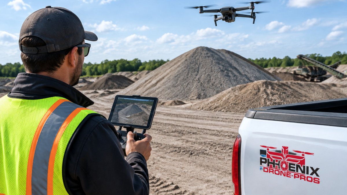
Drone stockpile volume measurement is the practice of flying an unmanned aerial vehicle over a pile of material, capturing overlapping aerial imagery, and converting that imagery into a 3D model from which volume is calculated. The core advantage is simple: you measure the pile without ever walking on it.
The workflow rests on photogrammetry. The drone captures hundreds of geotagged photos; software stitches them into a point cloud and a digital surface model; then the volume between that surface and a reference surface is computed. Researchers publishing in a 2025 ScienceDirect study on vision-based stockpile inventory found the approach safer and more cost-effective than conventional methods.
For a broader look at how this fits into site documentation, see our guide to aerial construction site mapping.
How to Measure Stockpile Volume with a Drone
Measuring a stockpile takes five steps, and skipping any one of them undermines the result. Here is the sequence we follow on site.
- Establish ground control. Place ground control points at known coordinates around the pile.
- Plan the flight. Set altitude, overlap, and a consistent flight path over the stockpile.
- Fly and capture. Collect overlapping aerial imagery across the full pile, including edges.
- Process the data. Build the point cloud and digital surface model in photogrammetry software.
- Calculate volume. Define the reference surface, then compute the volume between surfaces.
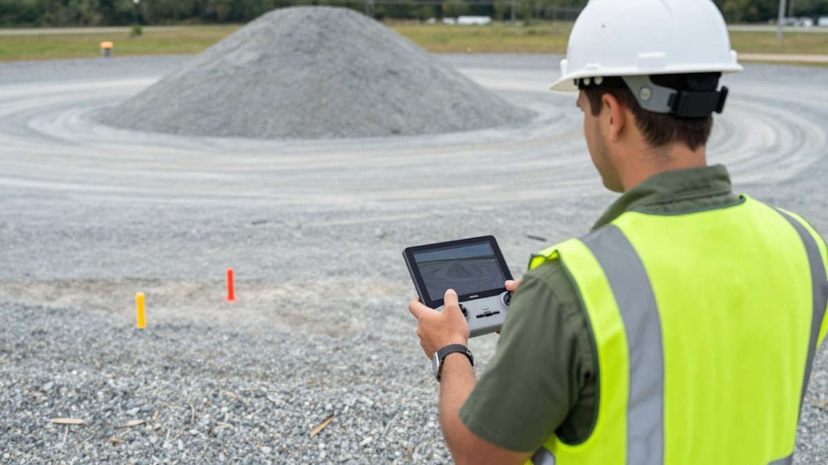
Ground Control and Flight Planning
Ground control points are the anchor of measurement accuracy. Without them, your 3D model floats in space and volume error grows. Propeller Aero conditions its 97-99% accuracy claim specifically on high-precision ground control such as AeroPoints, per Propeller Aero's accuracy guidance.
Flight planning matters just as much. Consistent altitude, generous image overlap, and a repeatable path let you compare this month's pile to last month's on equal terms.
Drone Stockpile Measurement Software Options
Software choice shapes how quickly raw imagery becomes a usable volume figure. The market splits into photogrammetry engines and dedicated stockpile platforms.
| Option | Best For | Notes |
|---|---|---|
| PIX4Dmapper | Surveyors building models | Photogrammetry engine |
| DroneDeploy | Repeatable monitoring | Saved flight plans |
| Propeller Aero | Stockpile workflows | Ground-control dependent |
| Birdi | Mining inventory | Volumetric management |
| Kespry Cloud | Mining teams | Firmatek-associated |
| Hammer Missions | Accuracy studies | Measurement workflows |
If platform costs are a concern, our breakdown of affordable alternatives to expensive drone mapping platforms covers the trade-offs.
Drone Stockpile Measurement Accuracy and Its Limits
Accuracy is not a fixed number you can promise on every survey. It depends on ground control quality, flight overlap, surface texture, and how carefully you define the reference surface. The useful question is not "what is the accuracy?" but "what is the error budget for this pile, and how is it reported?"
Where the error actually comes from
Most volume error traces to a handful of mechanisms, and each one is controllable:
- Ground control quality. Without surveyed control points, the model floats and volume error grows. Propeller Aero conditions its 97-99% accuracy claim specifically on high-precision ground control such as AeroPoints, per Propeller Aero's accuracy guidance. Sparse or poorly distributed control is the most common cause of a bad number.
- Surface conditions and texture. Fresh gravel and crushed stone reconstruct well; smooth, dark, wet, or highly reflective surfaces (fresh coal, wet sand, sheeted tarps) produce sparse points and a softer surface. Vegetation on or around a pile inflates the measured surface.
- Pile geometry and occlusion. Conical and windrow piles are straightforward. Re-entrant shapes, overhangs, bunkers, and piles against walls create occluded faces the drone cannot see, so the model interpolates, and interpolation is where volume quietly disappears or appears.
- Reference surface definition. The base of the pile is a modeling decision, not a measurement. A flat plane, a surveyed pre-pile surface, or a stockpile-specific base surface will each give a different number. Changing the method between surveys makes month-over-month comparison meaningless.
- Flight and processing settings. Altitude, overlap, and processing quality settings change point density. A saved, repeatable flight plan is what keeps two surveys comparable.
How to report uncertainty instead of a single number
A single volume figure with no stated method invites bad inventory decisions. A defensible report states the method and a margin alongside the number. A common pattern practitioners use is to report:
- The volume figure and the reference-surface method used to derive it.
- A confidence range (for example, a stated percentage band around the figure) tied to ground-control quality and surface conditions.
- The flight date, altitude, overlap, and processing settings, so the next survey can be compared on equal terms.
- The material density assumption used for any tonnage conversion, since volume and tonnage are not the same measurement, the Association for Drones stockpile monitoring guide makes this point directly.
Watch out: reporting a single volume figure with no stated uncertainty, or switching reference-surface methods between surveys, is the fastest way to turn a good measurement into a bad inventory decision.
Material-specific challenges
Different materials stress the workflow in different ways. Vegetation and covered piles (tarps, dust suppression) hide the true surface; bins and bunkers limit flight access and create occluded faces; changing base surfaces, a pit floor that has been excavated since the last survey, shift the reference plane under you. When converting volume to tonnage, material density is the dominant assumption, and density varies with moisture and compaction, so the tonnage figure carries more uncertainty than the volume figure. State the density assumption explicitly rather than burying it.
For how these accuracy practices fit into a repeatable site program, see our guide to aerial construction site mapping.
Drone Survey vs. Traditional Stockpile Survey
Traditional stockpile surveys rely on manual measurement and survey equipment, which means crews walking uneven piles and turnaround measured in days. A drone survey captures the same site in minutes and produces a repeatable digital record. That repeatable digital record also reduces the need for crews to work on uneven piles, extending the same risk-reducing logic to drone-powered safety solutions.
| Factor | Drone Survey | Traditional Survey |
|---|---|---|
| Data collection | Minutes per flight | Hours on foot |
| Worker exposure | Minimal | Crew on the pile |
| Repeatability | High with saved plans | Varies by crew |
| Output | 3D model, point cloud | Field notes, spot shots |
The real difference comes down to repeatability. A 2022 comparative study indexed by the University of Johannesburg repository set out to compare drone and traditional volumetric computation directly. To see how the resulting data plugs into your process, read how to integrate drone data into construction workflows.
Safety, Cost, and Inventory Benefits That Show Up on the Books
The benefits of drone stockpile volume measurement land in three places: safety, cost, and inventory control. Most guides stop at naming them. The useful version explains the mechanism behind each and how the numbers connect to decisions.
Safety: removing the crew from the pile
The safety win is structural, not incremental. A traditional stockpile survey puts a crew on an unstable pile with a rod or GPS rover; a drone survey captures the same geometry from the air. Drone workflows can reduce the need to walk on unstable stockpiles while cutting survey time and labor. The benefit compounds on active sites where piles are being built or drawn down, because the survey no longer requires coordinating a shutdown or a safe-access window.
Cost: build the total cost of ownership, not the flight price
A drone flight looks cheap next to a survey crew, but the honest comparison is total cost of ownership across a year of surveys. A transparent way to frame it is to list the cost components on each side and compare them at your actual survey frequency:
- Conventional side: survey labor hours per visit, equipment and calibration, site access and shutdown coordination, rework when a measurement is disputed, and the cost of inventory error itself (write-offs, emergency orders, carrying cost).
- Drone side: hardware (owned or contracted), software subscription, ground-control hardware or service, pilot labor per flight, processing time, and training.
The pattern most operations find is that the drone side has a higher fixed cost and a much lower marginal cost per survey. That means the ROI improves as survey frequency rises, monthly or weekly inventory cycles favor drones far more than an annual count. Rather than quoting a single payback figure, run the comparison at your own frequency and include the cost of a wrong inventory number, which is usually larger than the survey cost on either side.
Inventory: from volume figure to business decision
The inventory benefit only shows up if the volume output reaches the systems that make decisions. A 3D model that lives in a folder is a deliverable, not a benefit. The practical path is:
- Volume to tonnage. Apply a stated material density to convert volume into tonnage, and carry the density assumption and confidence range forward with the number.
- Tonnage to inventory. Feed the tonnage figure into inventory or stock-accounting records on a consistent cadence so drawdown and build-up are tracked against production and sales.
- Inventory to operations. Use the same figures for dispatch planning, reorder triggers, and financial forecasting. DJI Enterprise's stockpile guidance links accurate measurement to better supply chain logistics, more detailed financial forecasts, and fewer write-offs.
- Audit trail. Keep the flight date, method, and confidence range with each figure so an inventory number can be defended later.
Industrial case studies of drone-based stockpile measurement often report gains in safety and speed, though results vary by site. If jobsite safety is your priority, see active jobsite drone safety done right.
Scheduling Your First Drone Stockpile Survey
Booking a survey comes down to three questions: can the provider fly your site legally, what data will you receive, and how fast?
Controlled airspace is the usual sticking point near industrial sites and airports. Confirm your provider can operate there, which is why our drone services in controlled airspace page matters before you book.
We are FAA-certified, fully insured, and have more than 10 years of commercial drone experience. Pricing depends on site size, flight count, and delivery, so reach out for a current quote.
Manual stockpile measurement keeps crews on unstable piles and leaves your inventory numbers open to interpretation. Phoenix Drone Pros replaces that with repeatable aerial surveys, detailed 3D models, and accurate volume reporting.
Frequently Asked Questions
How accurate is drone stockpile measurement?
Accuracy depends on the measurement setup, not the drone alone. Accuracy depends heavily on high-precision ground control and a properly defined reference surface. Without reliable ground control points and a properly defined reference surface, errors grow. Treat any accuracy figure as a statement about a controlled workflow, and ask your operator what ground control and processing steps they use before you rely on the numbers for material valuation.
Is a drone survey worth it for stockpile measurement?
For most aggregate, cement, and mining operations, yes. Drone surveys are often reported to improve safety and speed compared with manual measurement. The break-even point depends on how often you measure: sites that count inventory monthly or track volume change weekly recover survey crew labor fastest.
What is the best software for measuring stockpiles?
The right drone stockpile measurement software depends on your workflow. Several platforms support stockpile volume measurement from drone survey data, and saved flight plans can help make surveys repeatable. PIX4Dmapper processes imagery into photogrammetric models for volume calculation, and Birdi, Kespry Cloud, and Hammer Missions appear in mining-focused comparisons. Confirm pricing directly with each vendor, since none of them publish rates in the available sources.
How long does a drone stockpile survey take?
Drone surveys can capture an entire site in minutes, then generate repeatable volumetric calculations for comparison. The flight itself is the short part; processing imagery into a point cloud or 3D model and checking it against ground control adds time. A multi-pile yard with tight turnaround expectations is best scoped with the operator up front so you know when deliverables land.